The last day of January was quite mild, starting around 6 degrees C and climbing to 11C at one point. It did, however, begin very rainy – but models showed a dry patch in the early afternoon, so I prepared the Bombadil for a ride – two water bottles, checked the tire pressure (aka gave them a squeeze and they still felt pretty firm, so OK), and packed my small Fabs Chest with a sit-pad, tool roll, snacks, warm layer, and extra gloves.
As soon as the rain had definitively stopped, I headed out the door. I rode west towards downtown, as on the far side of downtown is Stanley Park and then the Lions Gate bridge into North- and West Vancouver. The bridge deck is 10 km from my door. There are paved and unpaved options through Stanley Park, of course I tend to opt for the unpaved unless in a rush. Today I was certainly not in a rush and also detoured to Beaver Lake to take in its beauty with the moody skies.
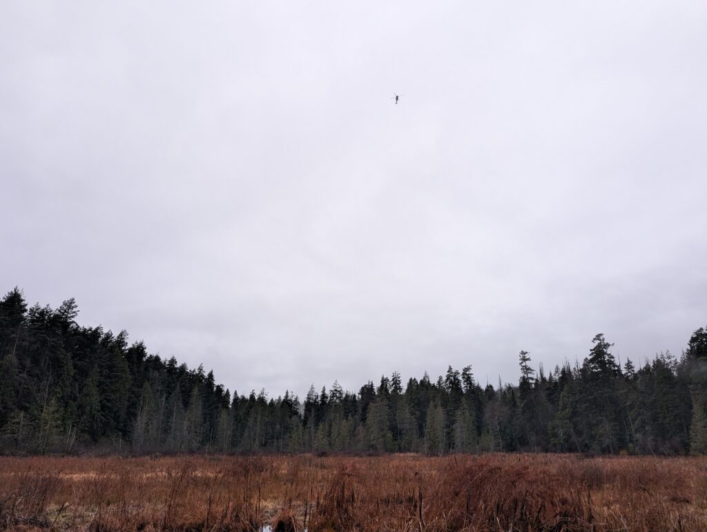
Above, a helicopter flies above Beaver Lake, Stanley Park. My Bombadil along its edge below.
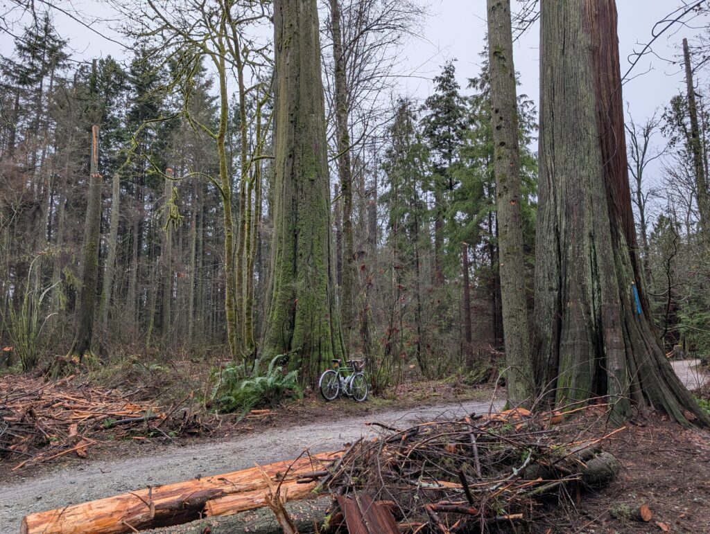
I took Reservoir Trail towards the bridge, which was closed last time I passed through, and now I see it was because of resurfacing. This trail has one steep climb rather than a longer, more gradual climb of its neighbours – but it also has a nice old growth cedar midway up the climb that I like to visit once in a while.

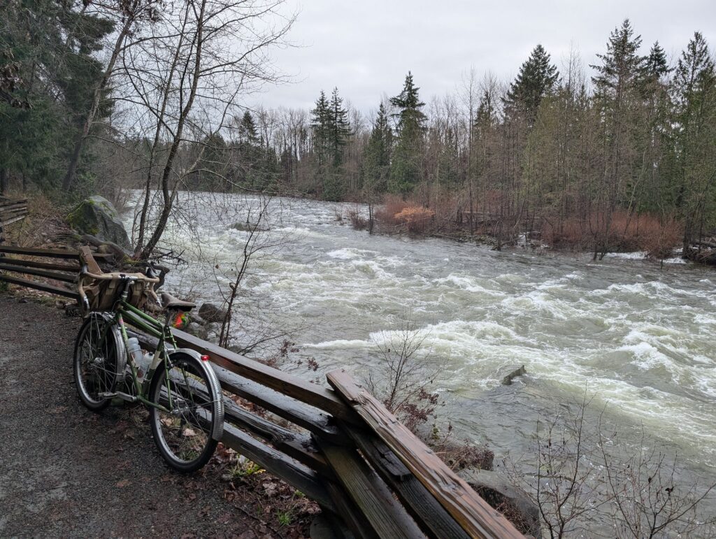
Capilano River is near the north end of the bridge, and a trail along its bank takes me to my preferred “high route” into West Vancouver. I was also keen to see the water level – as you can see below, it was high! Not only have we had a lot of rain the past days, but rapid snow melt from the mild temperatures too.
The next few kilometres were not too visually exciting, a series of quiet side roads and connecting paths, but they are a very comfortable and enjoyable way to get up to Cypress Bowl Rd versus the more common routes. I’ve probably done it about 25 or 30 times now, and only relatively recently have I been remembering each turn without question.
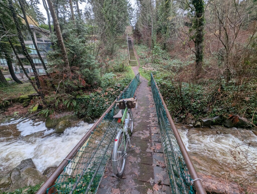
I tried something new to me, which was the above crossing of Rodgers Creek. I checked it out on street view beforehand but couldn’t see anything except either end – there were more stairs than I expected, as often happens to me, but it was really nice otherwise! Would do again. The only other way across this creek is the main road down near the water and the highway further up. Perhaps in summer I’ll try hiking up the creek itself.
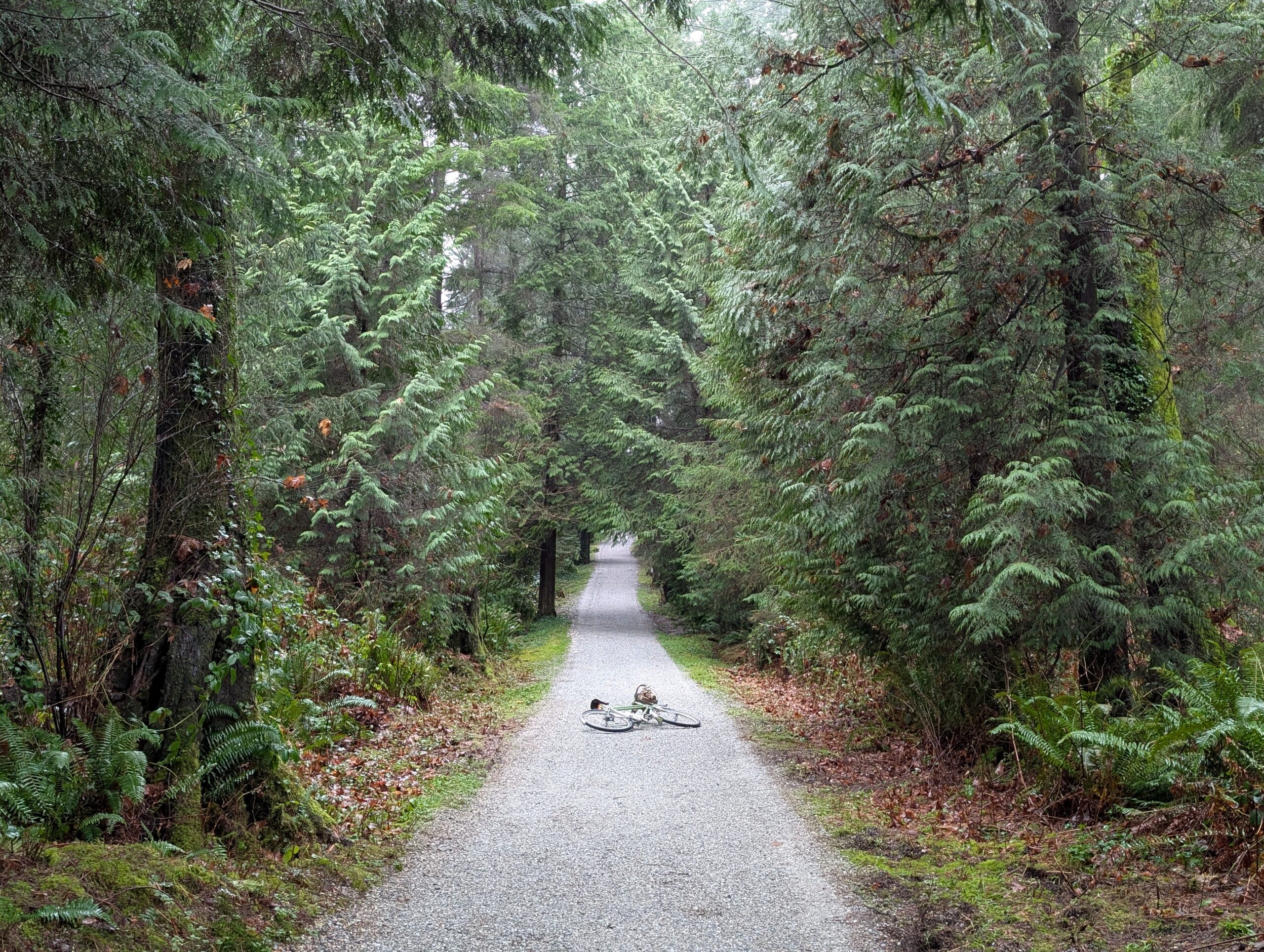
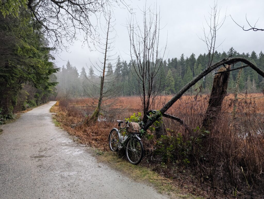
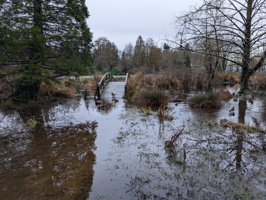
On the way home I passed through Stanley Park again, taking a combination of gravel paths and unofficial trails – some of which turned into muddy hike-a-bike. As you can see below, the water level was pretty high all around!
Here’s the route detail. A nice medium-length wander!
Leave a Reply