Back when the pandemic still had most regular social situations still shut down, Rob took on a project to try to find a way to get to the top of each of the three local mountains by staying off pavement as much as possible. He eventually decided it simply was not possible to do in a way that he could send other people on; there was simply too much, and too difficult, hike-a-bike involved.
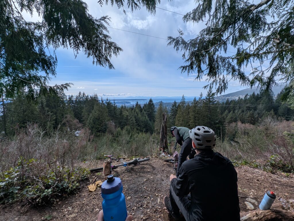
This was the lower part of the grouse/fromme route, and for some reason we decided to do it again even though we knew how bad it was. I think we all minimized how long the bad section was. In fairness the views after the bad section all but made up for it, and you do feel a sense of accomplishment when you manage to drag your bike up sections of trail so steep they have ropes.
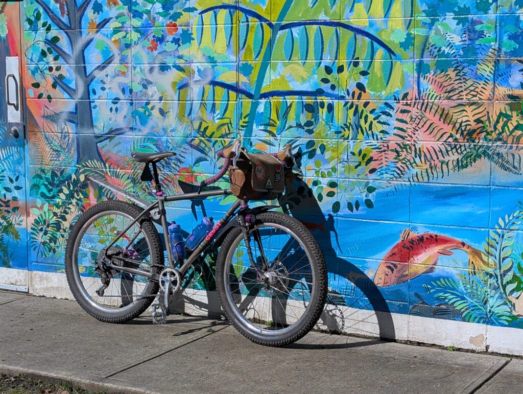
My steed for the day was the Evasion, naturally. It’s not a light bike, but it’s very capable for a drop bar rig. I would have prefered flat bars today but my only disc brake flat bar bike is the Scrambler, which was simply too much bike for the ride. I am working on fixing this. I love my Rivs and I love rim brakes, but these mixed terrain rides that have proper steep sections really are better with discs. Especially when there’s mud!
The first 150m or so of climbing was up a wide, well-maintained gravel path along Mosquito Creek. Those who know the area may be familiar with just how quickly that accommodating path turns to shit once you pass this sign. At some point it abruptly turns into the trees and scrambles along the very steep embankment.
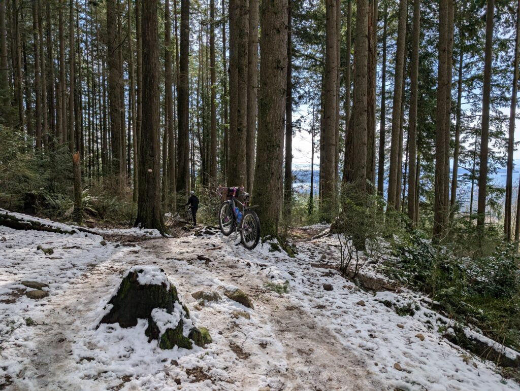
Below is the basically where things change. That’s Tay on her Beachcomber, a bike I have on order for delivery later this year – can’t wait to use it for rides like this! The Evasion is, and always was, a temporary solution while I wait for my Beachcomber.
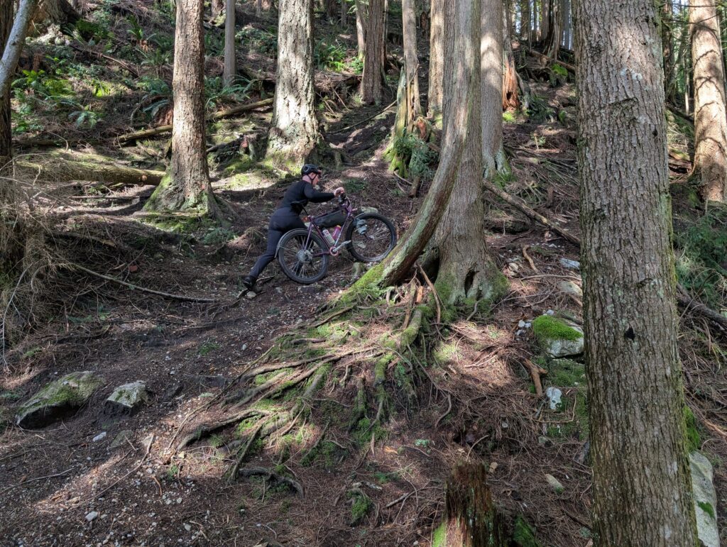
While the first 150m was spread out over a couple kilometres, the second 150m happened in about 400m of distance: the average incline was 40%. I am writing this the morning after, and I can tell you my upper body feels like I went to the gym for the first time in years. Every muscle I can think of is sore, but in a good way.
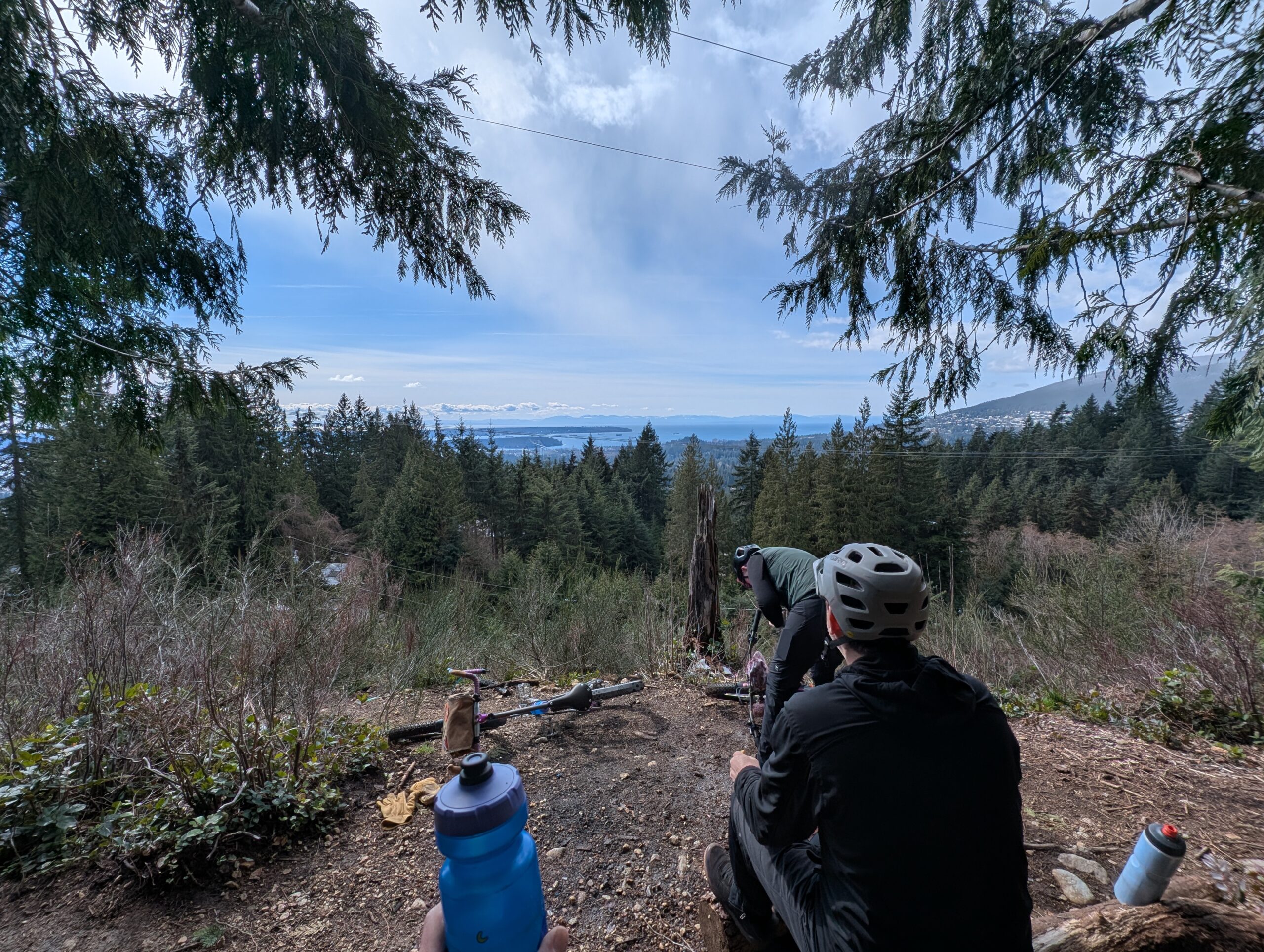
We also made it to some snow; this was at the 300m elevation mark which was about as high up as we got for the day. And also, the lookout. Kinda made it all worthwhile to see the bridge you biked from off in the distance.
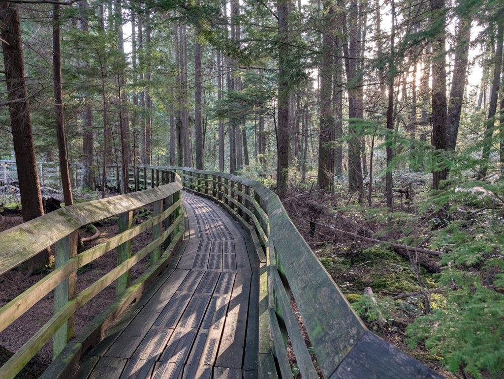
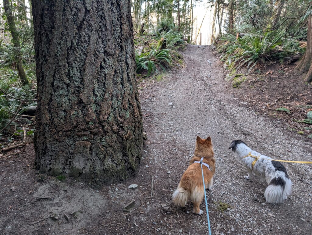
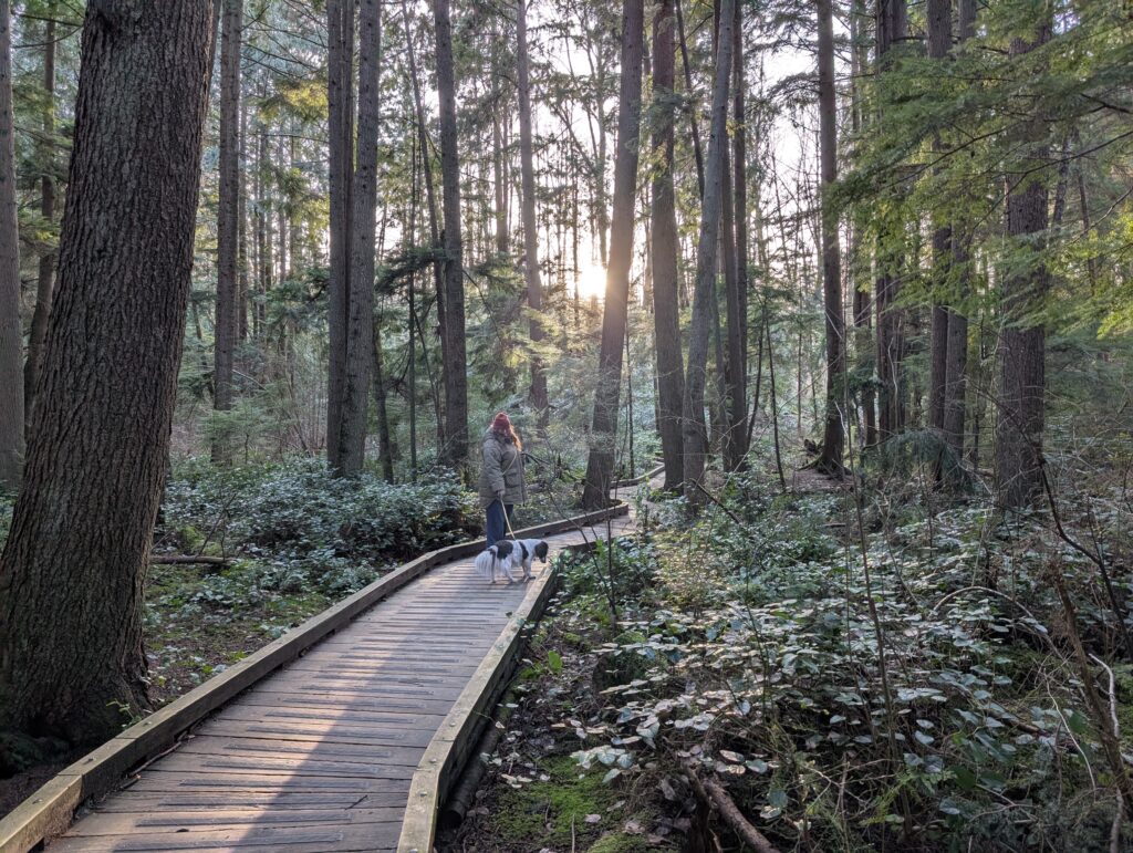
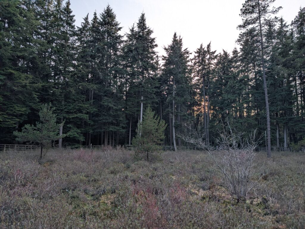
But wait, there’s more! After the lookout I didn’t take any more photos of the ride, even though we weren’t halfway yet at that point. Finished up at 37km and about 700m elevation. Thanks to the long daylight hours I was also able to then get in the car with the family and head to Pacific Spirit Park about a 40 minute drive away and do a nice woods walk with the dogs. We walked around Camosun Bog and through a section of forest that’s about as old as you can find in town – check out the size of that Doug Fir with the dogs for scale! Also some western red cedars of 3-4′ diameter in the area. Not sure how old they are but they seem older than the growth from after this area was logged in the 1880s to 1930s. Suppose they could be just 150 years old.
Leave a Reply