This is it, the last week before Daylight Savings kicks in. To make it sweeter still, our province announced that this will be the last time we have a time change, and we’re sticking with Daylight Savings – so never again will the sun set before 5pm here!
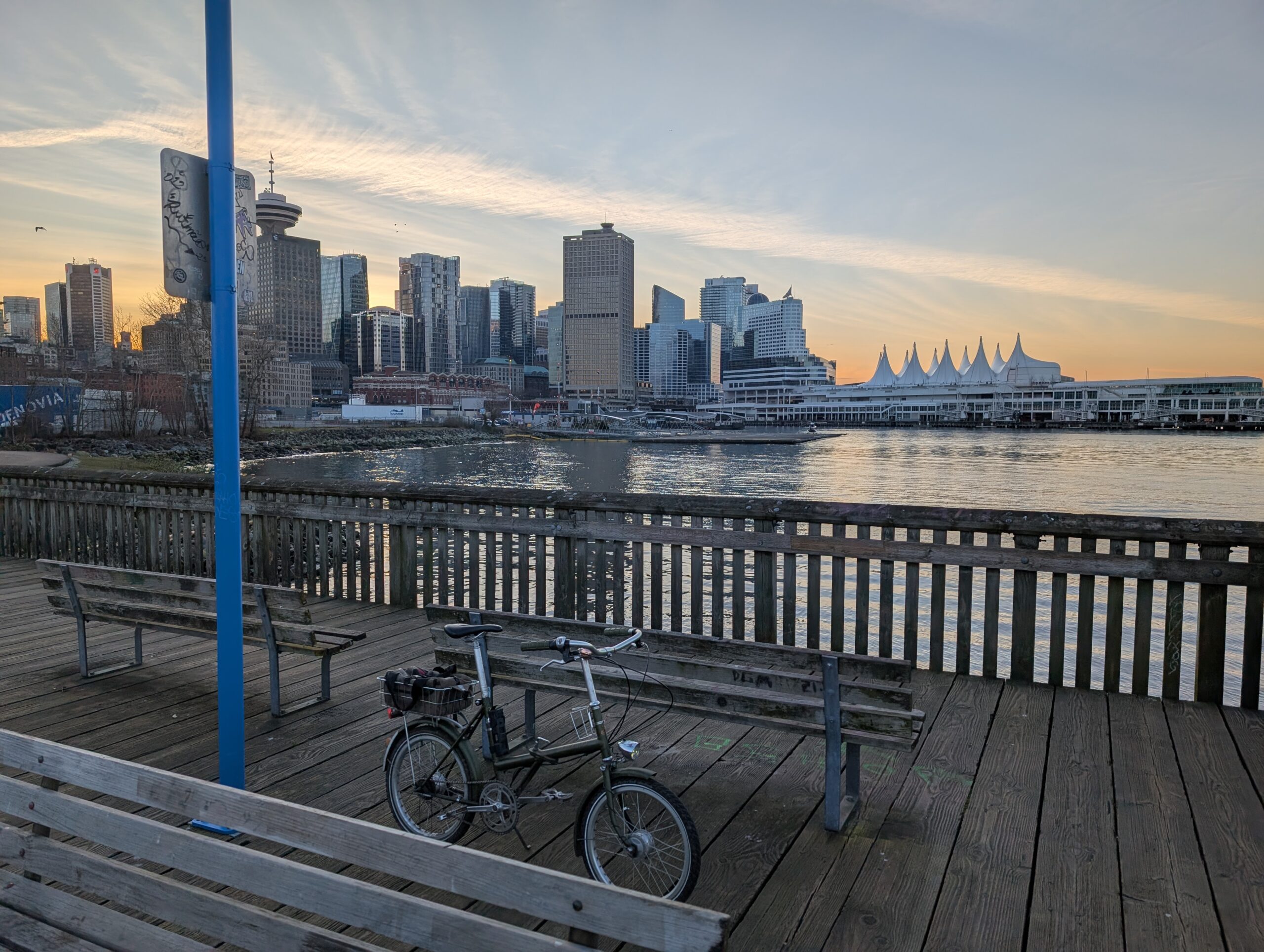
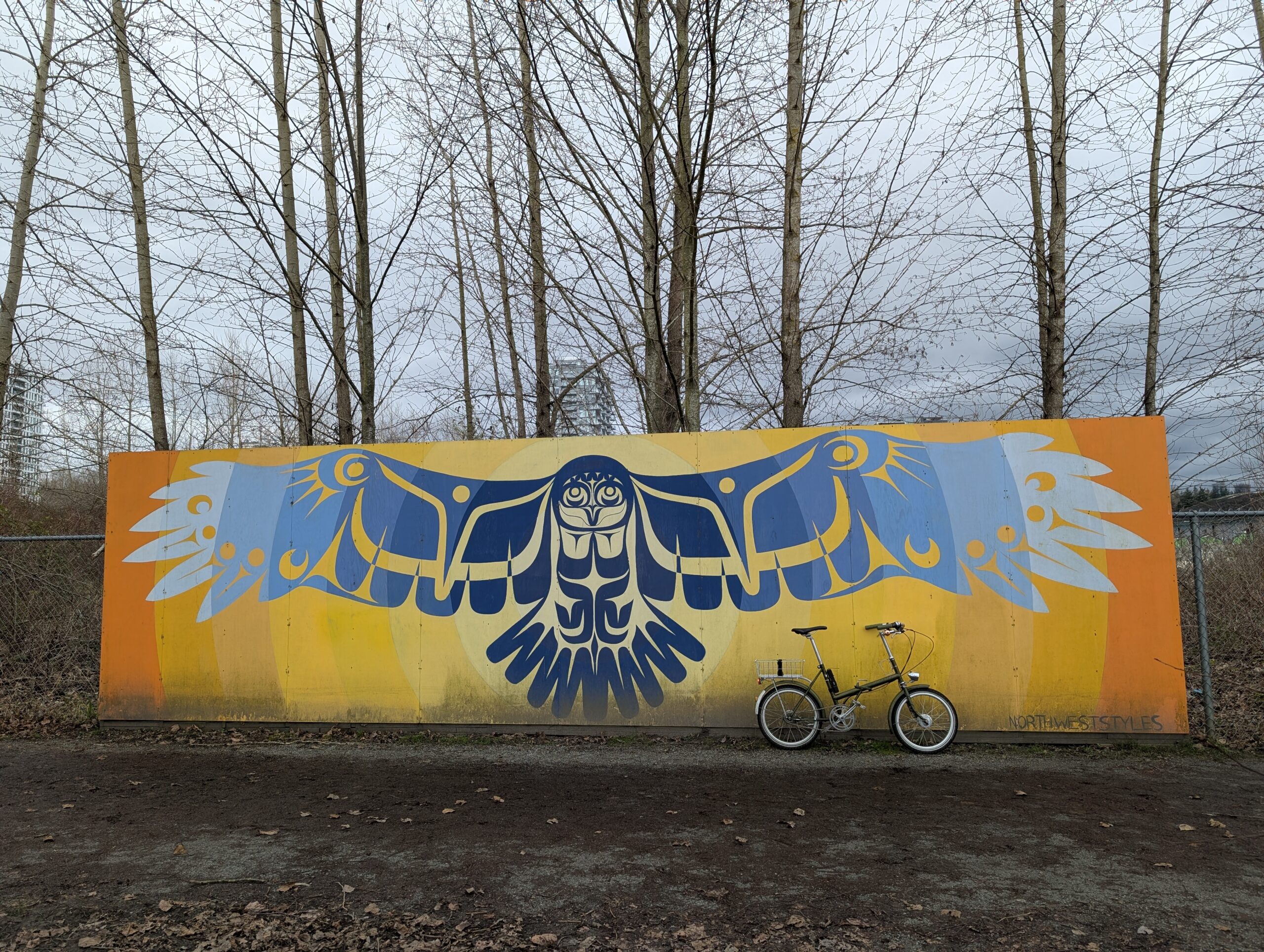
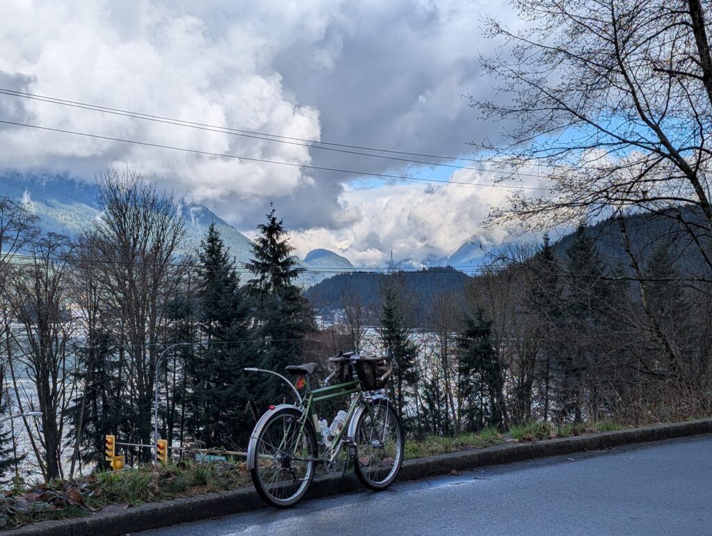
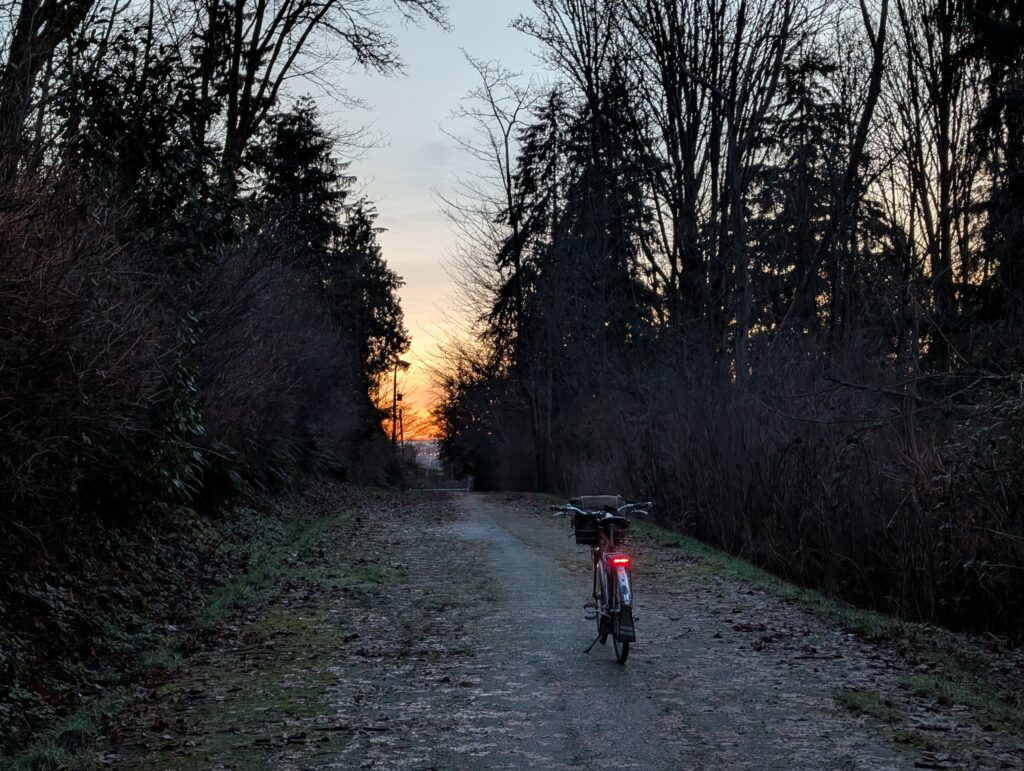
I rode out to this pier near Railtown, about 5 km from home, for a beer. With both Rivs torn apart at the moment, the choice to take the Twenty was pretty easy.
I went out for the sunset but it was the moonrise that stole the show. The moon was full and bright, and appeared huge while it hung near the horizon – the photo was the best I could do with my phone camera, but appeared twice as big in real life.
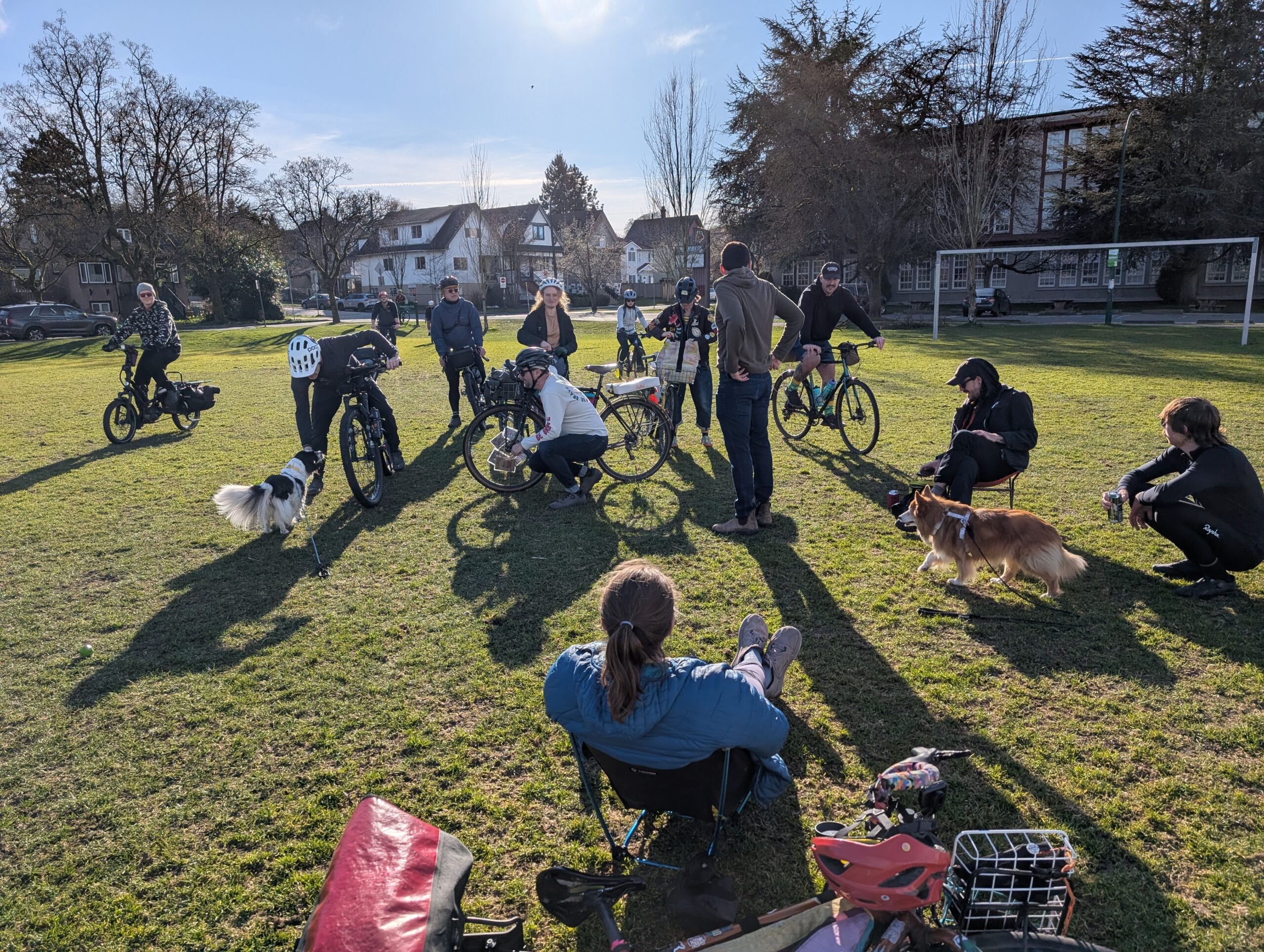
I’ve been telling people Leia is 13 years old for almost two months now, but today it’s officially true. As we’ve been doing for a bunch of years now, Aimée made dog cake (in cupcake form this time) and we went to Pandora park and invited dog friends out to join. About a dozen folks were able to make it out, helped by the great weather this day.
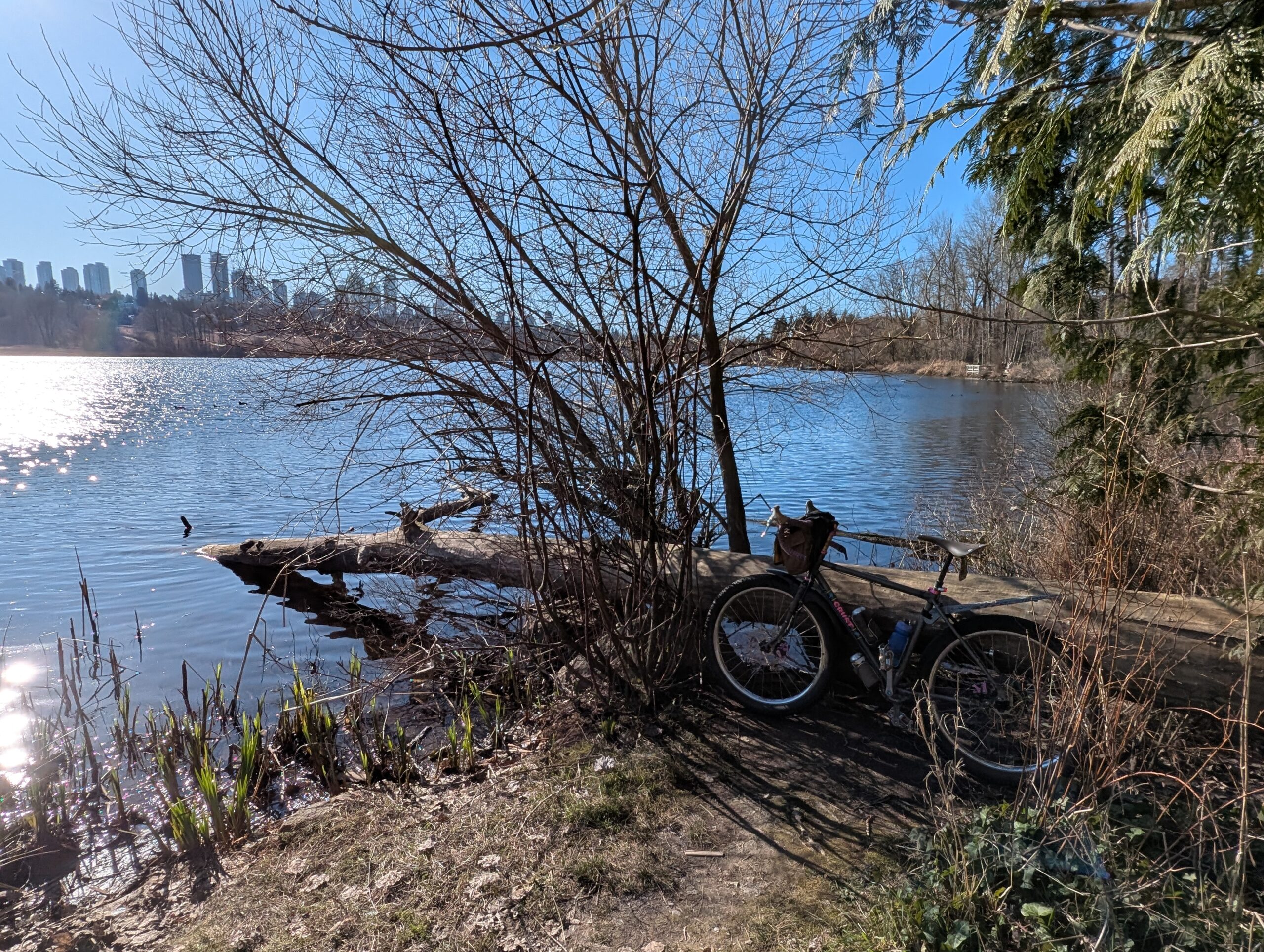
We were at the park from 11am to 1pm for the birthday celebration, but with the sun still high in the sky I decided to ride the Evasion out to Deer Lake – my first ride of any substance in two weeks. In that time the early bloomers have started to put on a show and remind us that spring is not far off now!
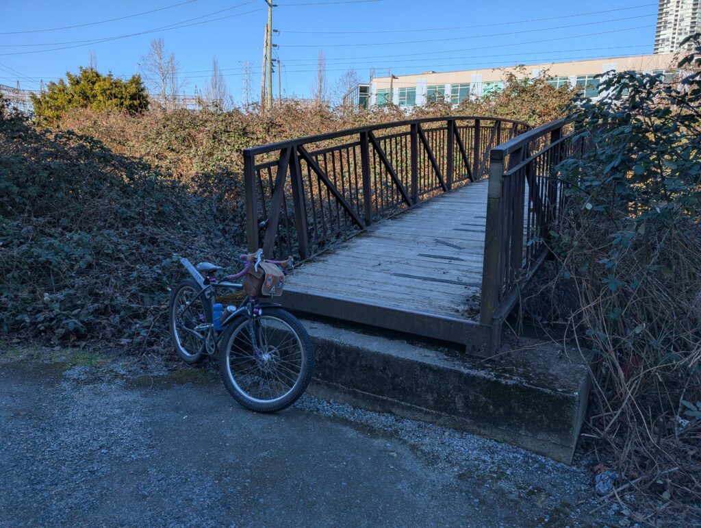
I spotted this bridge from the road, one I hadn’t seen before, so naturally I had to ride over it – and nearly endo’d off the end not realizing the second “step” was about 18″ tall! This does not seem like a compliant bridge…
My favourite tree to sit in was unavailable at Deer Lake due to the influx of park goers brought in with the warm air and sunshine. Can’t complain. I found another spot which was also quite lovely.
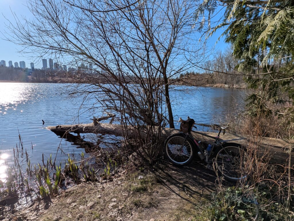
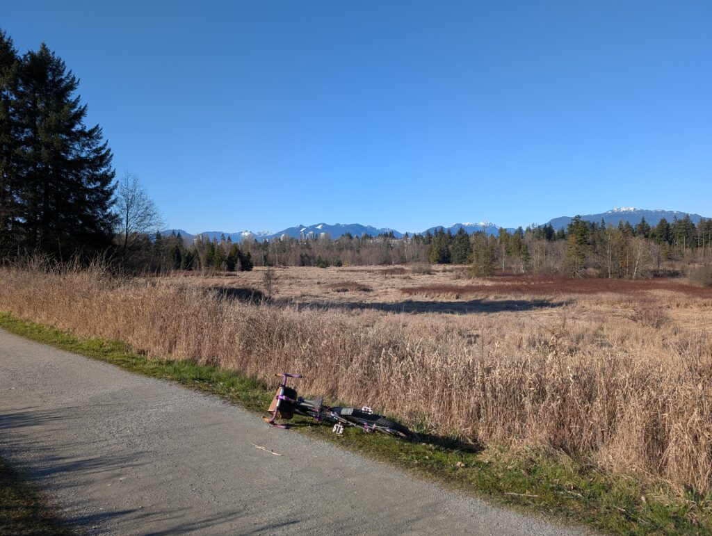
The grasslands around the lake are somewhat unique in this area these days, though I imagine this would have been a more common scene before we developed just about the whole land mass. The land was so beautiful before we got our hands on it, and I will cherish what still remains.
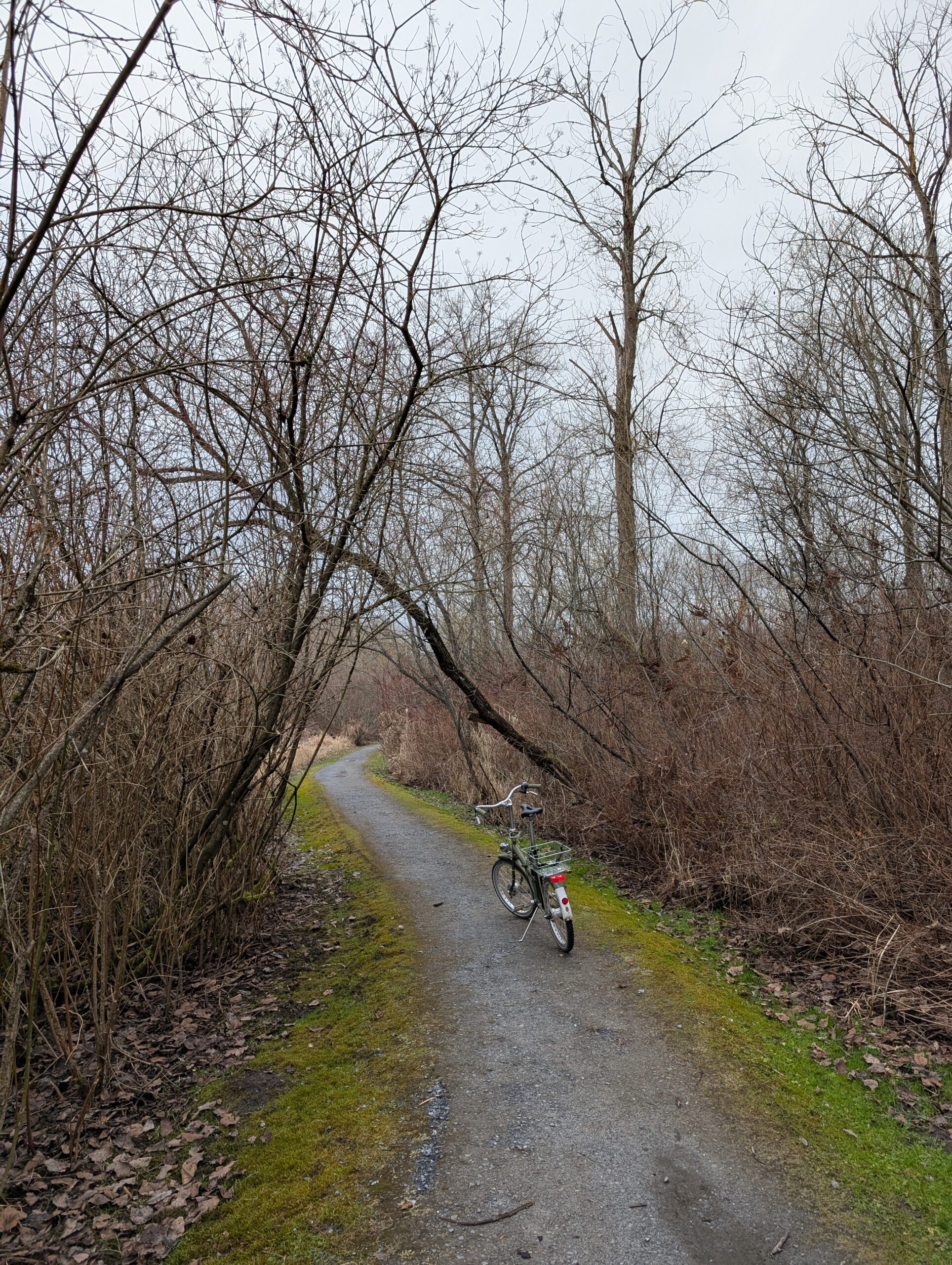
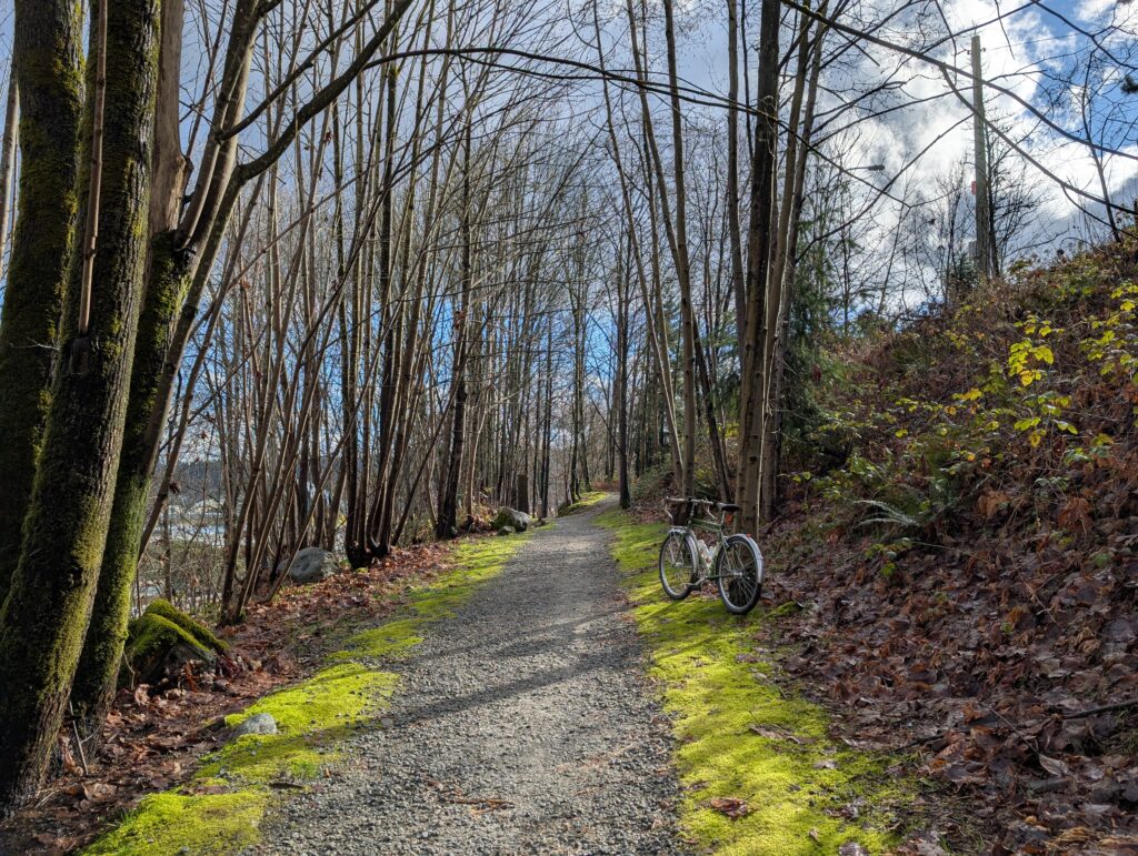
I spotted this little hummingbird in a blooming tree while exploring a dead-end fence line trail. The trail shown below is a little hidden gem in Burnaby that I always like to work into my loop.
I couldn’t join this edition of parkbagging on my bike, but the finish park was only three blocks from my place so I walked over with the dogs. Leia has been having some health stuff but is still spry and enjoys being outside.
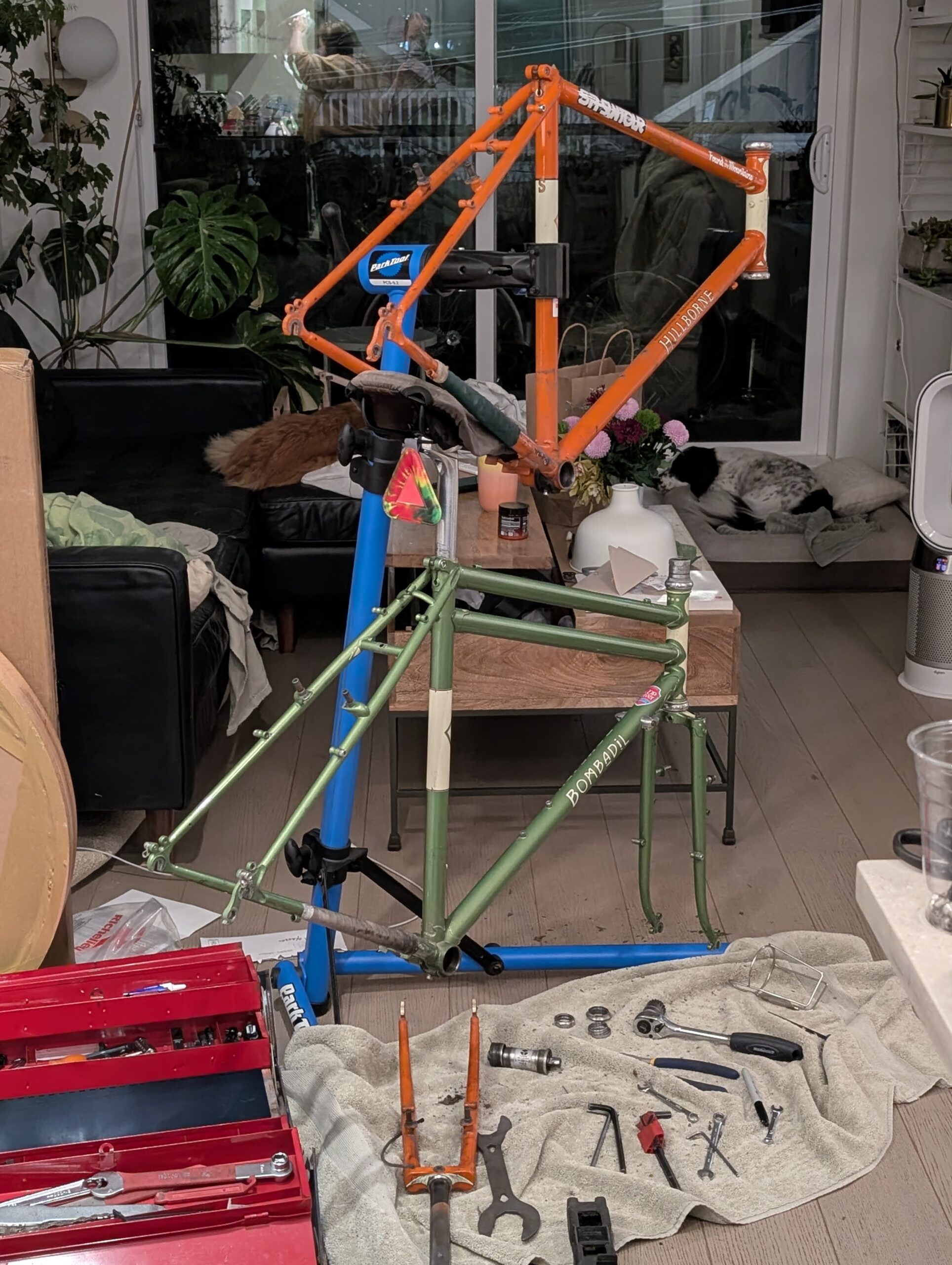
This weekend I decided I’d finally do a full tear-down and rebuild on the two Rivendells in my possession. The primary reason for going right down to a frame was actually so I could weigh them – I’ve always been curious. The Hillborne frame was 2144g while the fork was 860g, which is really quite light. The Bombadil on the other hand, a rather stout 2826g for the frame but a respectable 940g for the fork. Not a huge surprise.
The differential was bigger than I expected though and it helped solidify my plan to rebuild the Hillborne into the sporty drop bar bike again, after the Bombadil’s been filling this role for almost a year now. The Bombadil will resume “mule bike” duties with the pannier rack and the upright KT bar and become my commuter once again.
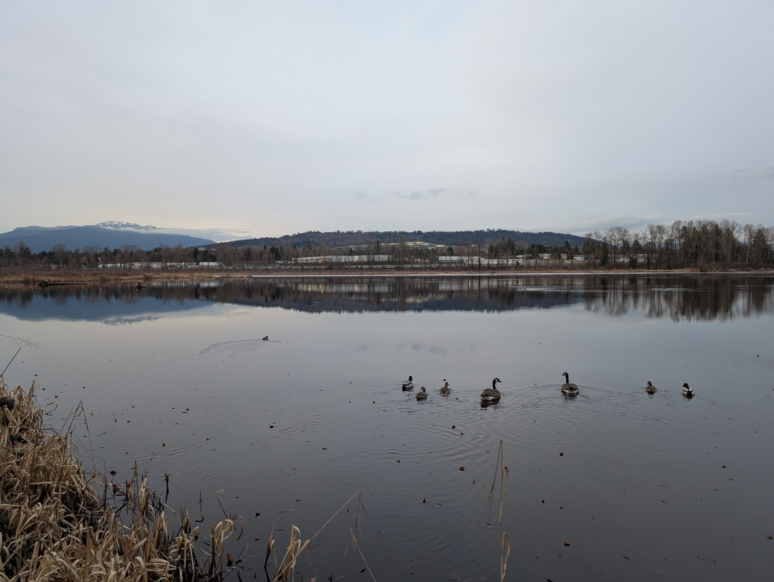
The high proportion of bird photos recently are more to do with me being sick and unable to go for proper rides than the increased interest in birding, though the latter is certainly a factor as well. In order to prevent my remarkably long activity streak on Strava from lapsing (306 weeks! Only missed a week during lockdown!) I drove down to a large park along the Fraser River, where I could bike around slowly on the flat pathways. There are also a lot of birds here, and as I realized today, a lot of birders too. I guess I never noticed them before.
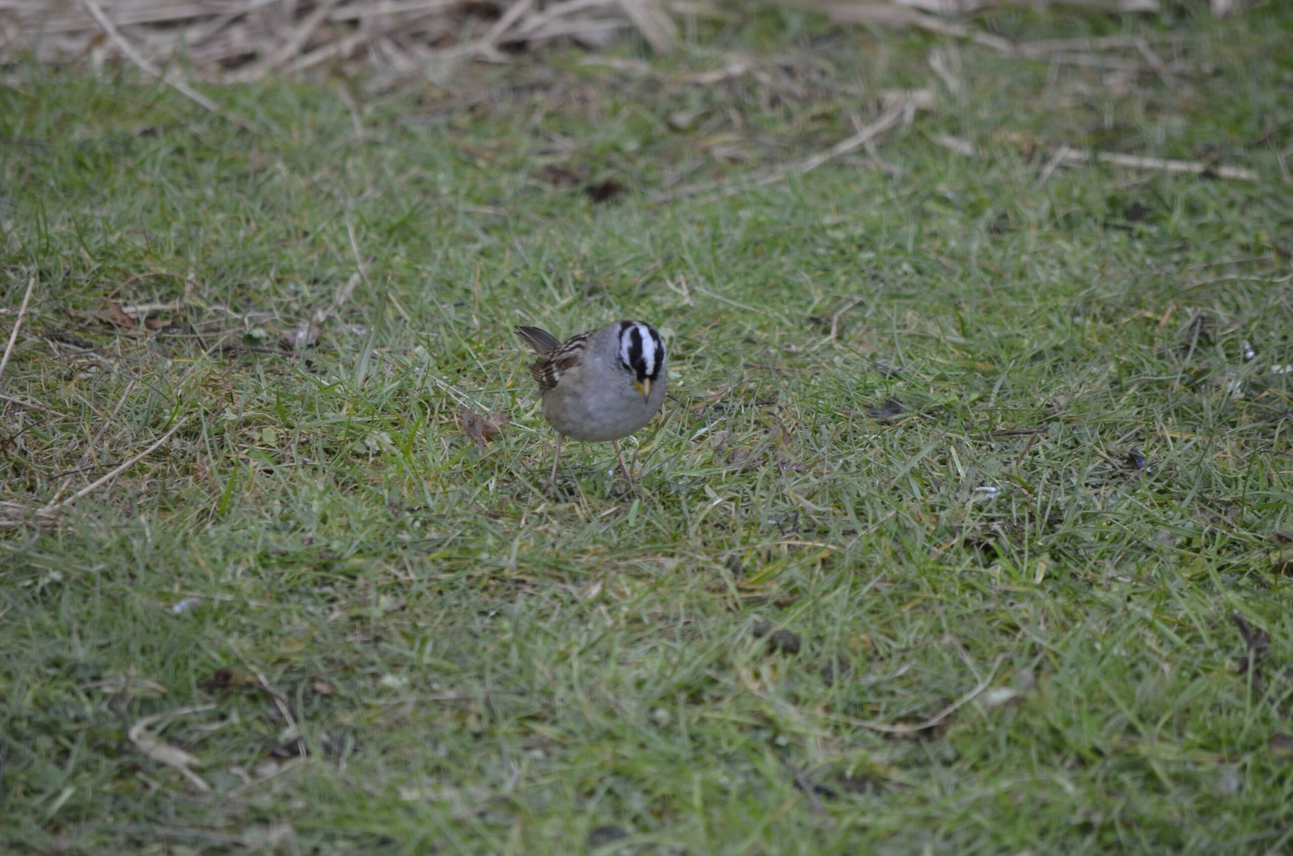
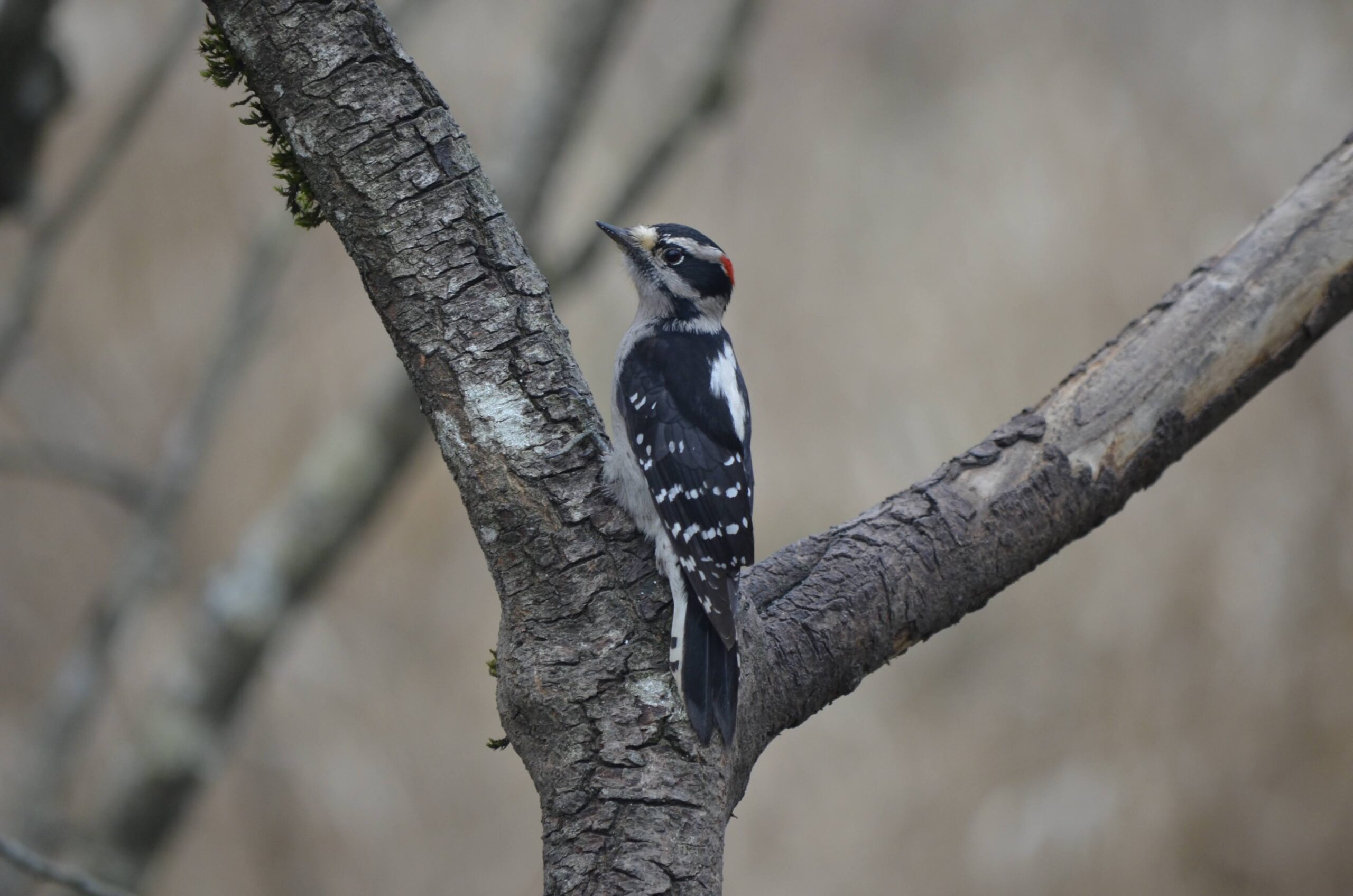
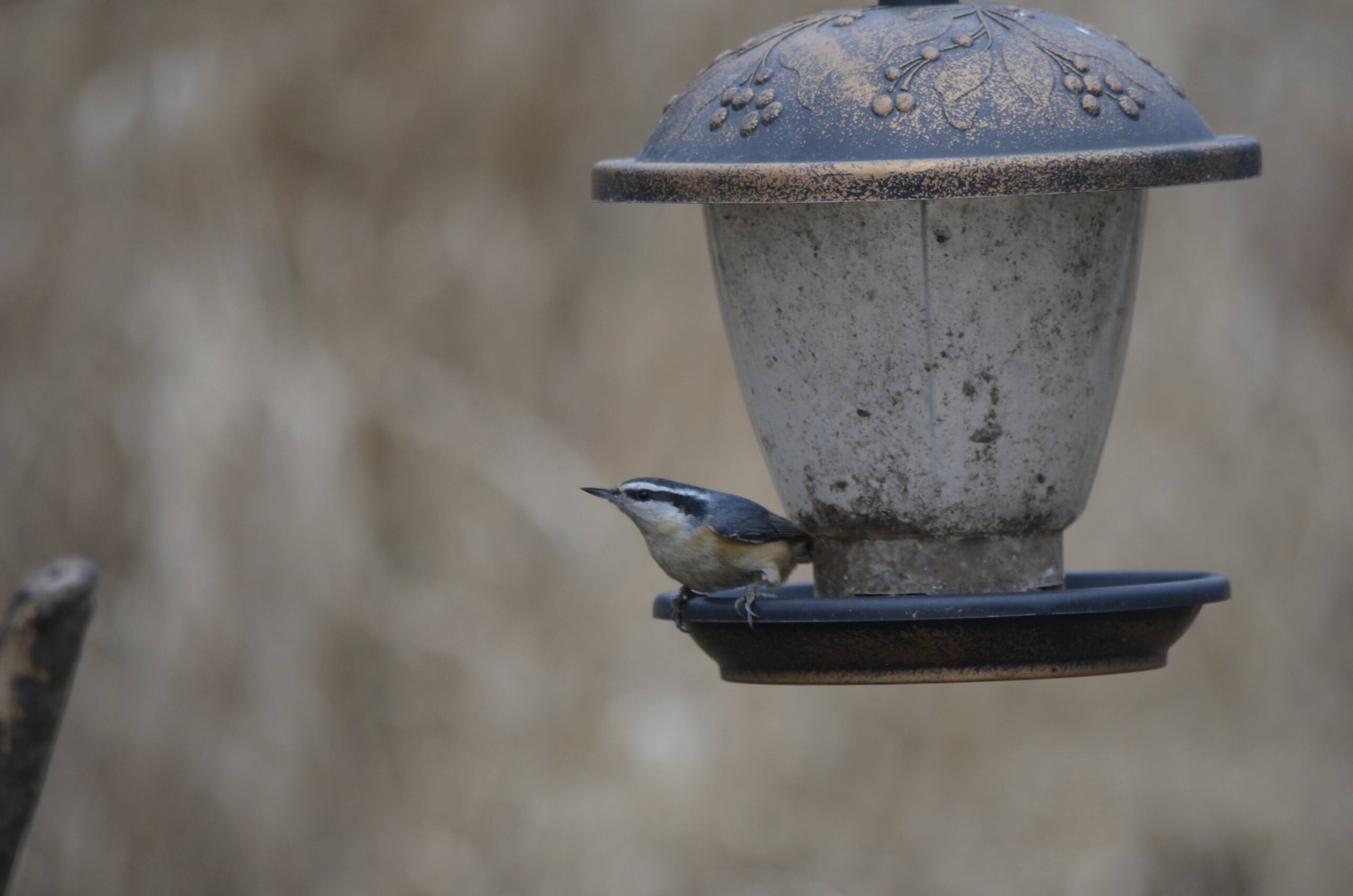
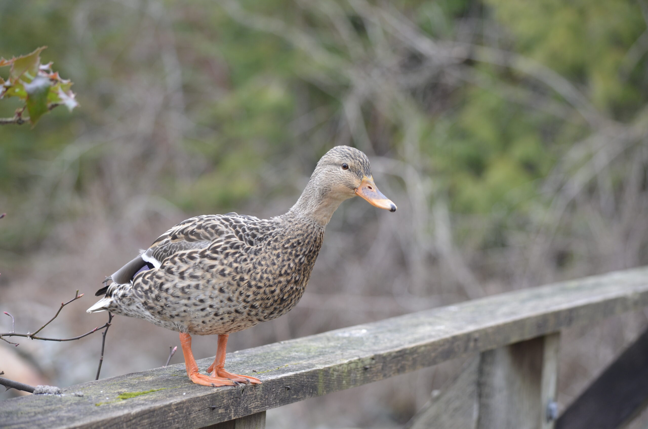
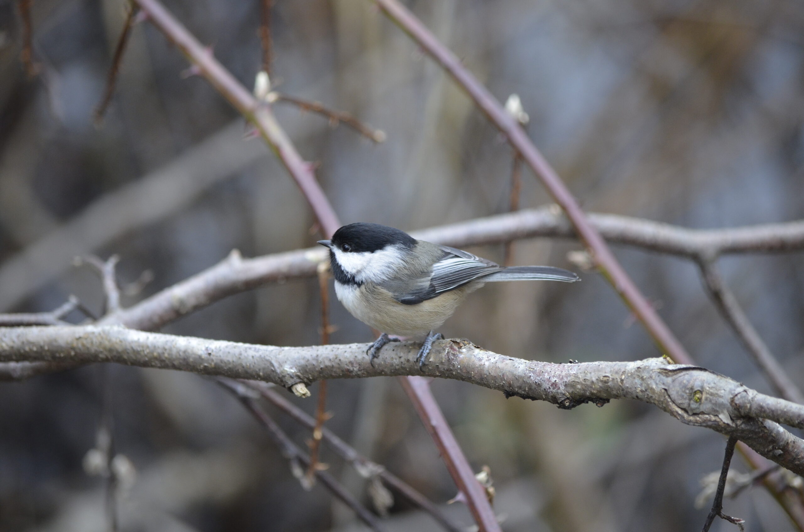
And onto the bird photos! Some new ones for me – first downy woodpecker, first white-crowned sparrow, first nuthatch too. I am still very much a newbie but I’ve noticed my ability to talk to a birder I come across and sound like I sort of know what I’m talking about is growing rapidly. I’m looking forward to springtime even more now with this newfound hobby; I already appreciate a lot about spring, now I’ve got one more aspect to enjoy.
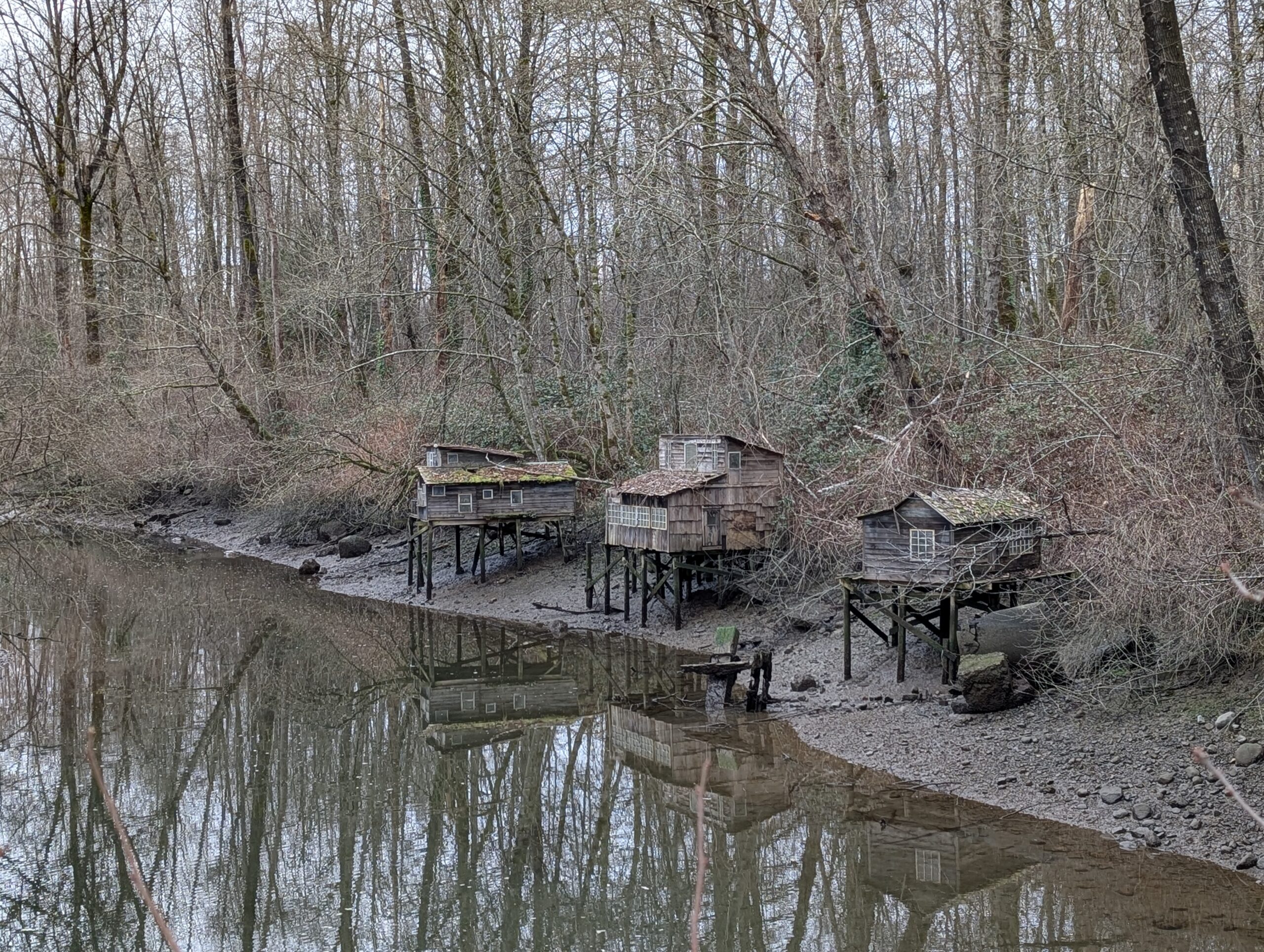
I’m currently too under the weather to ride, so instead I went for a walk around Maplewood Flats in North Vancouver with my old DSLR and photographed some birds. As you come into the nature preserve, there are these scale models of the now-gone squatter shacks that used to exist along the mudflats. Pretty cute.
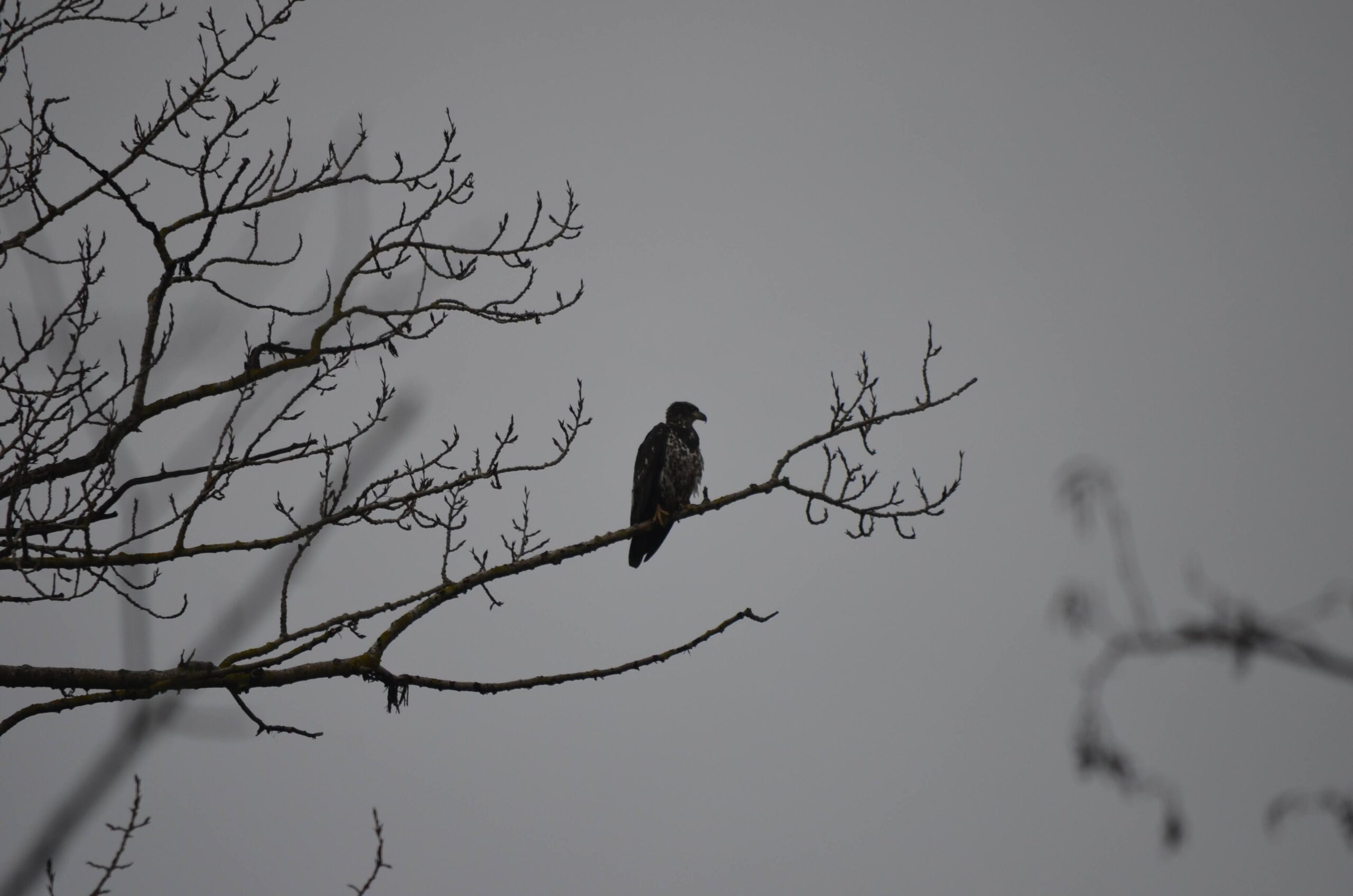
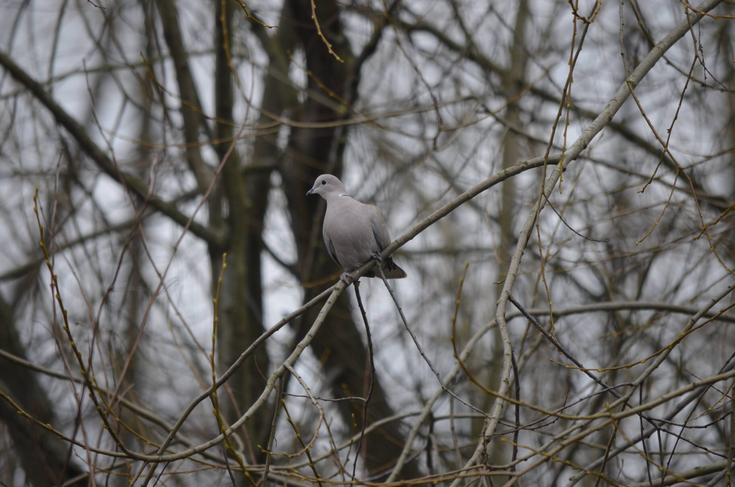
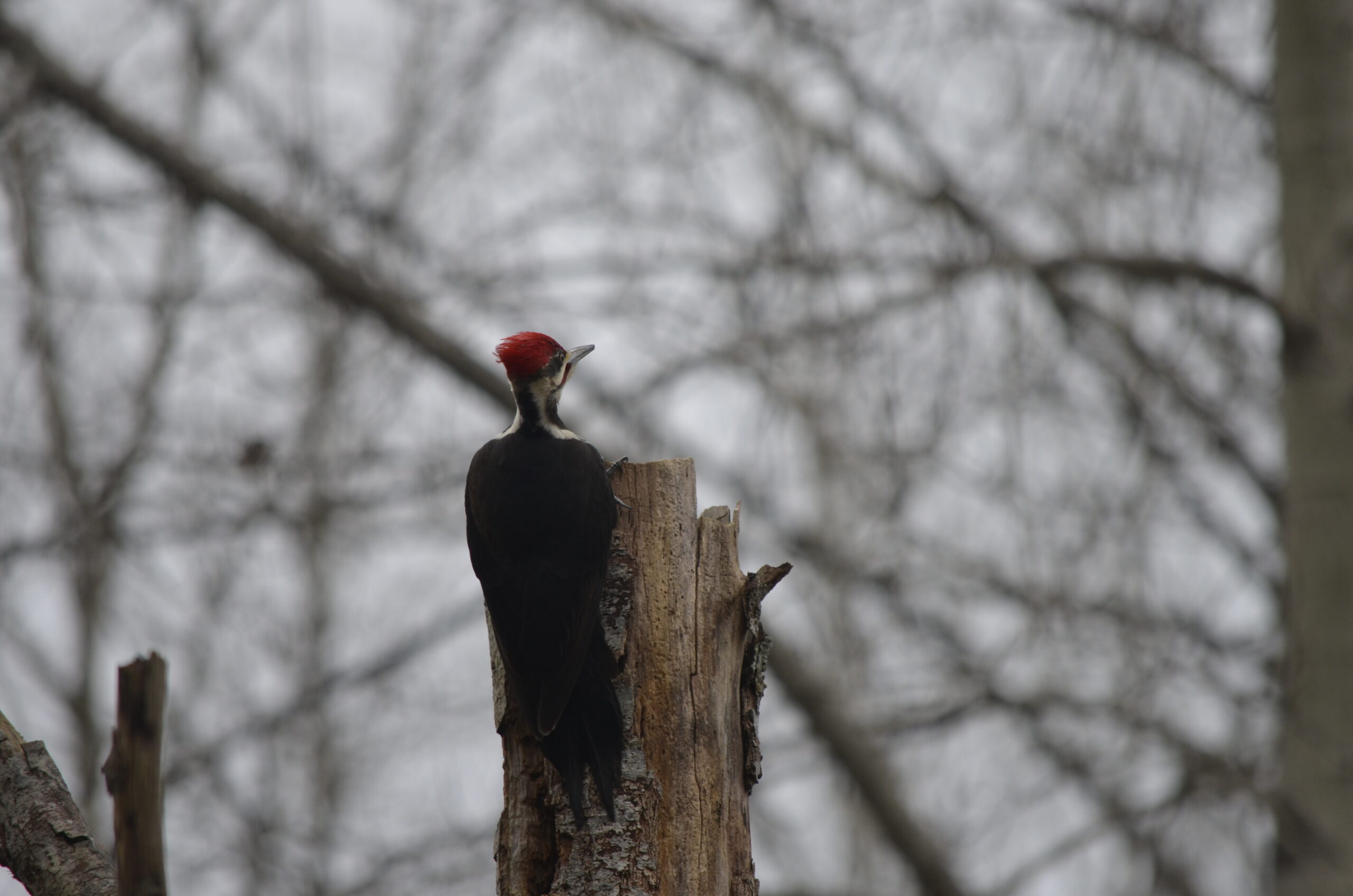
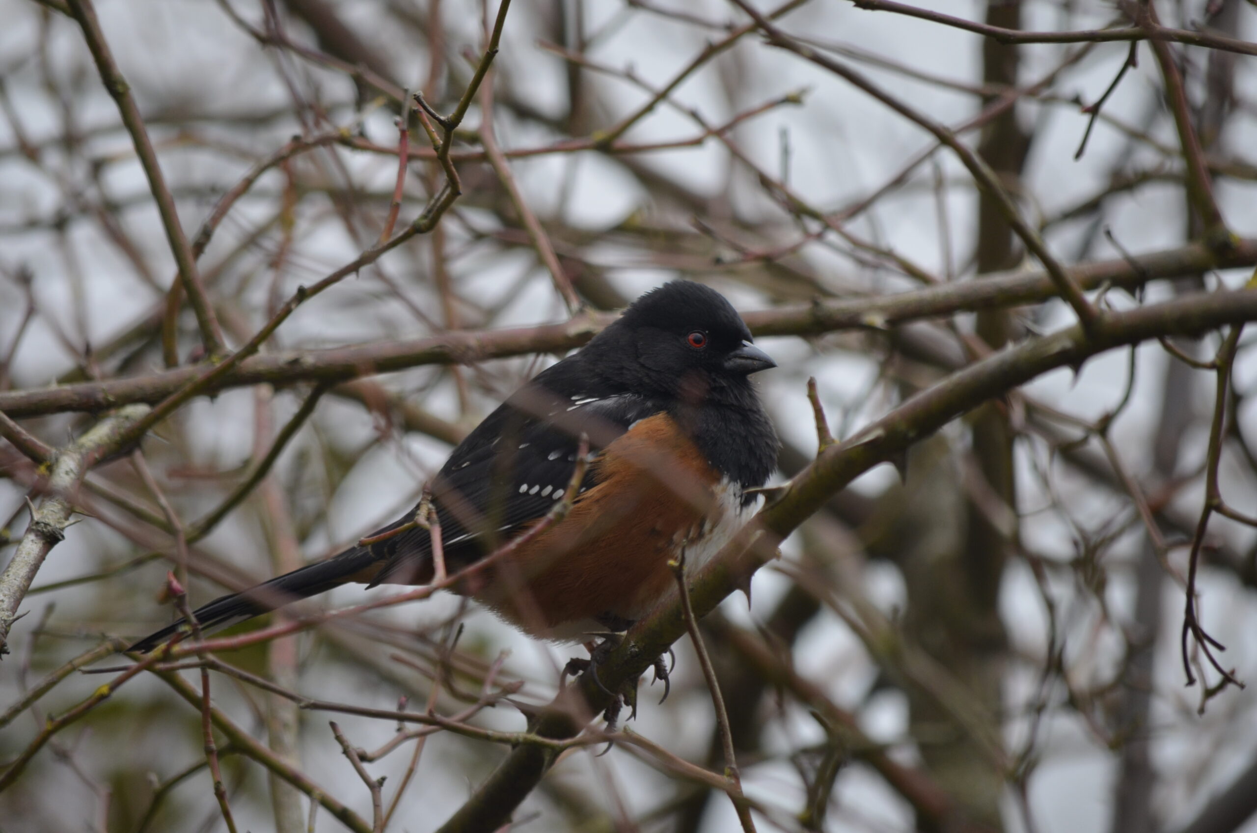
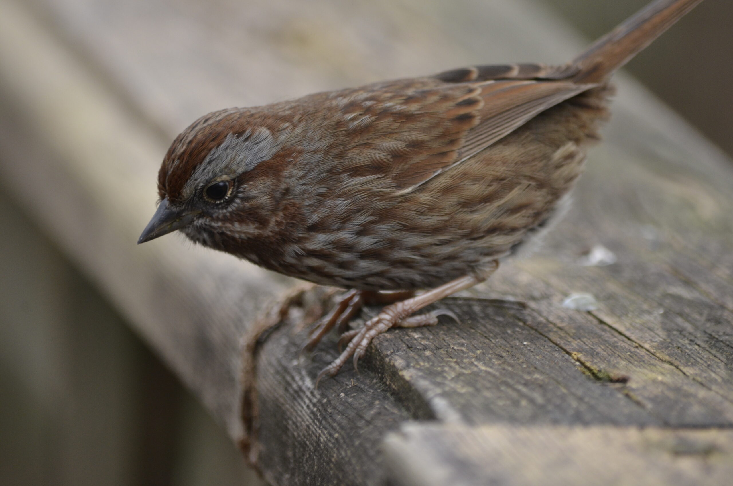
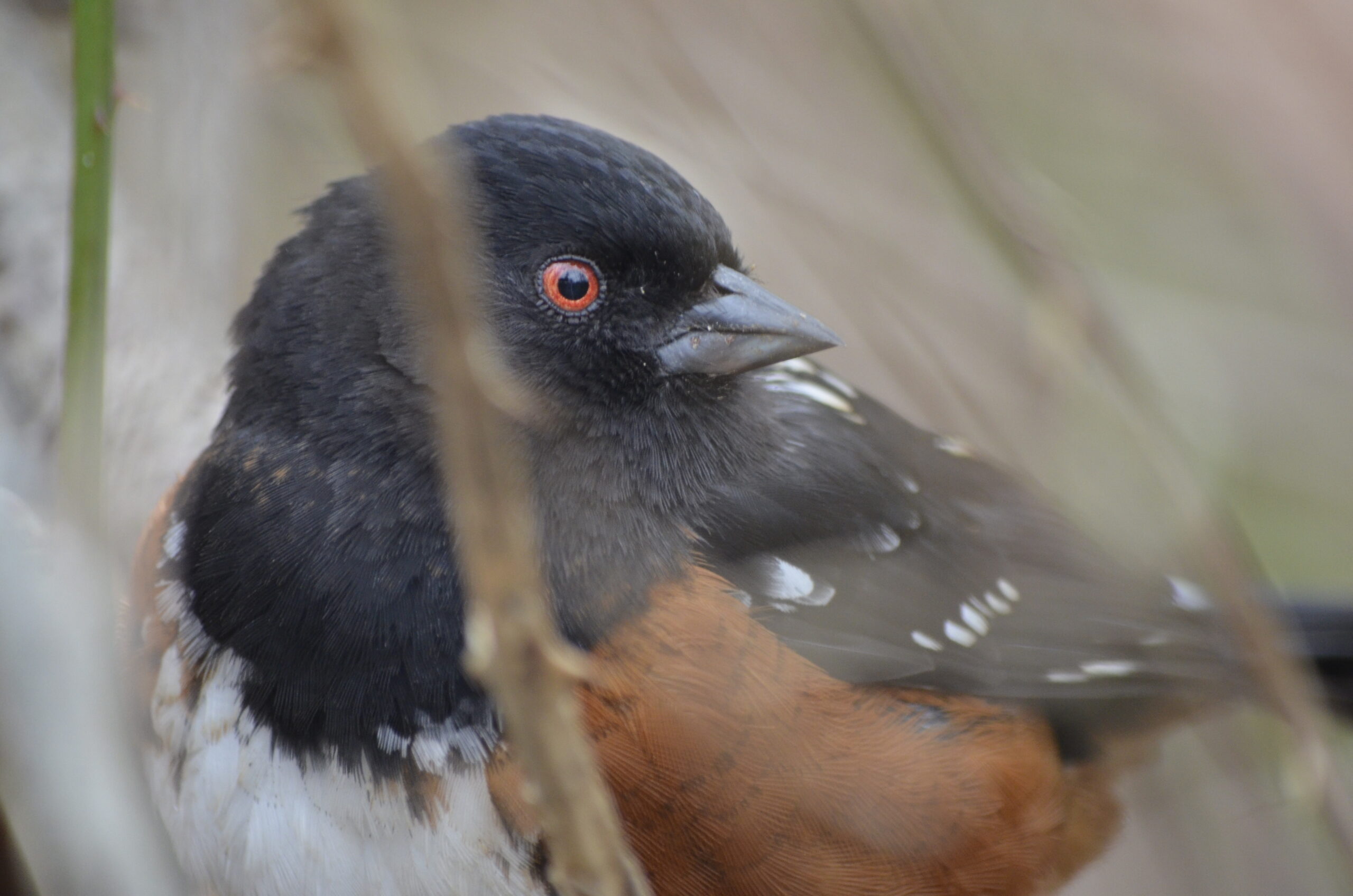
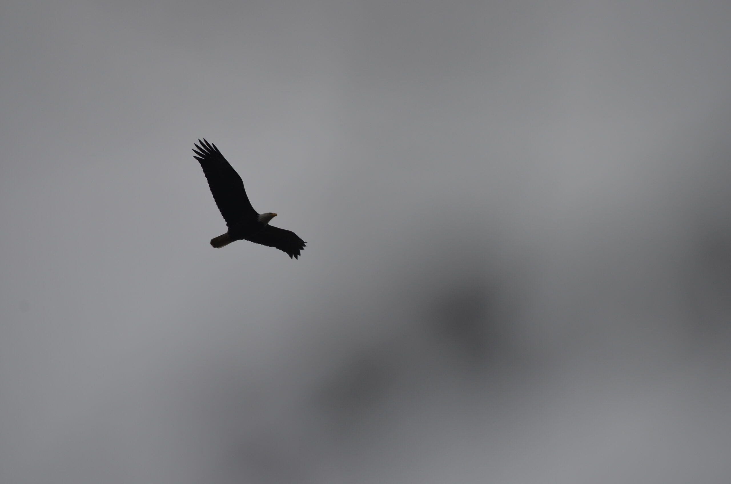
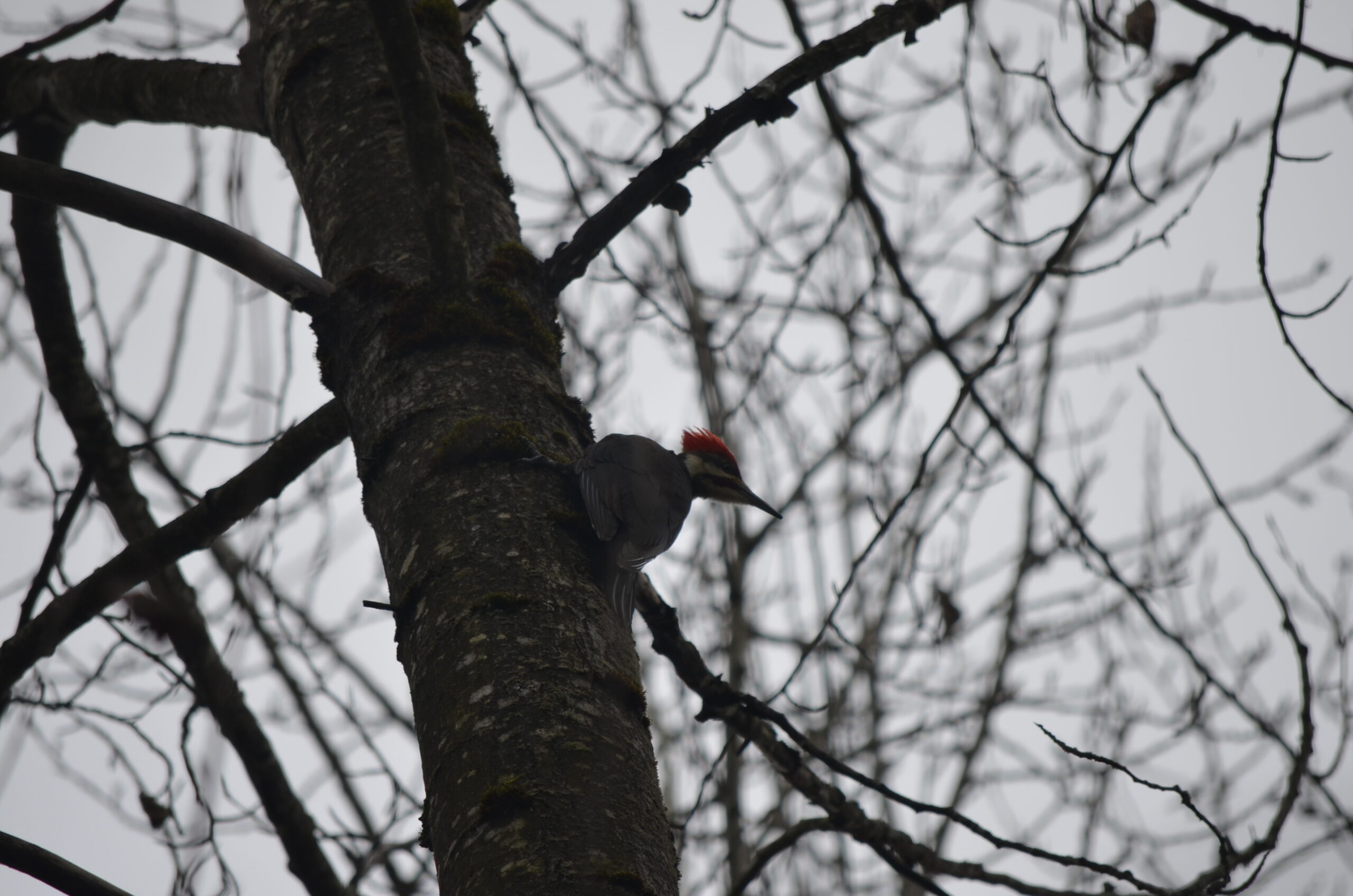
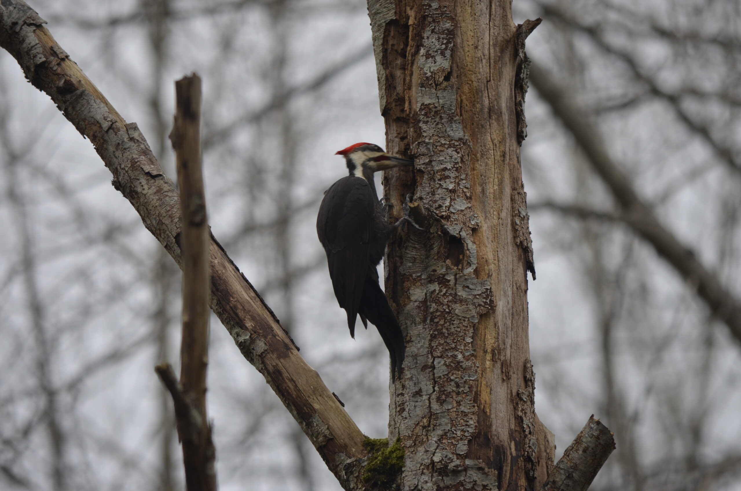
I mostly saw pretty ordinary birds, as expected. Lots of black-capped chickadees and spotted Towhees, as well as song sparrows. A couple eagles, and then the one bit of proper excitement was this pileated woodpecker which I heard at first, waited a few minutes, and then it swooped in and landed right by where I was standing. It then moved over to another dead tree even closer to me. They’re pretty big! Anyway, I guess I’m a birder now. I would have rather gone on a bike ride, but this was good too.
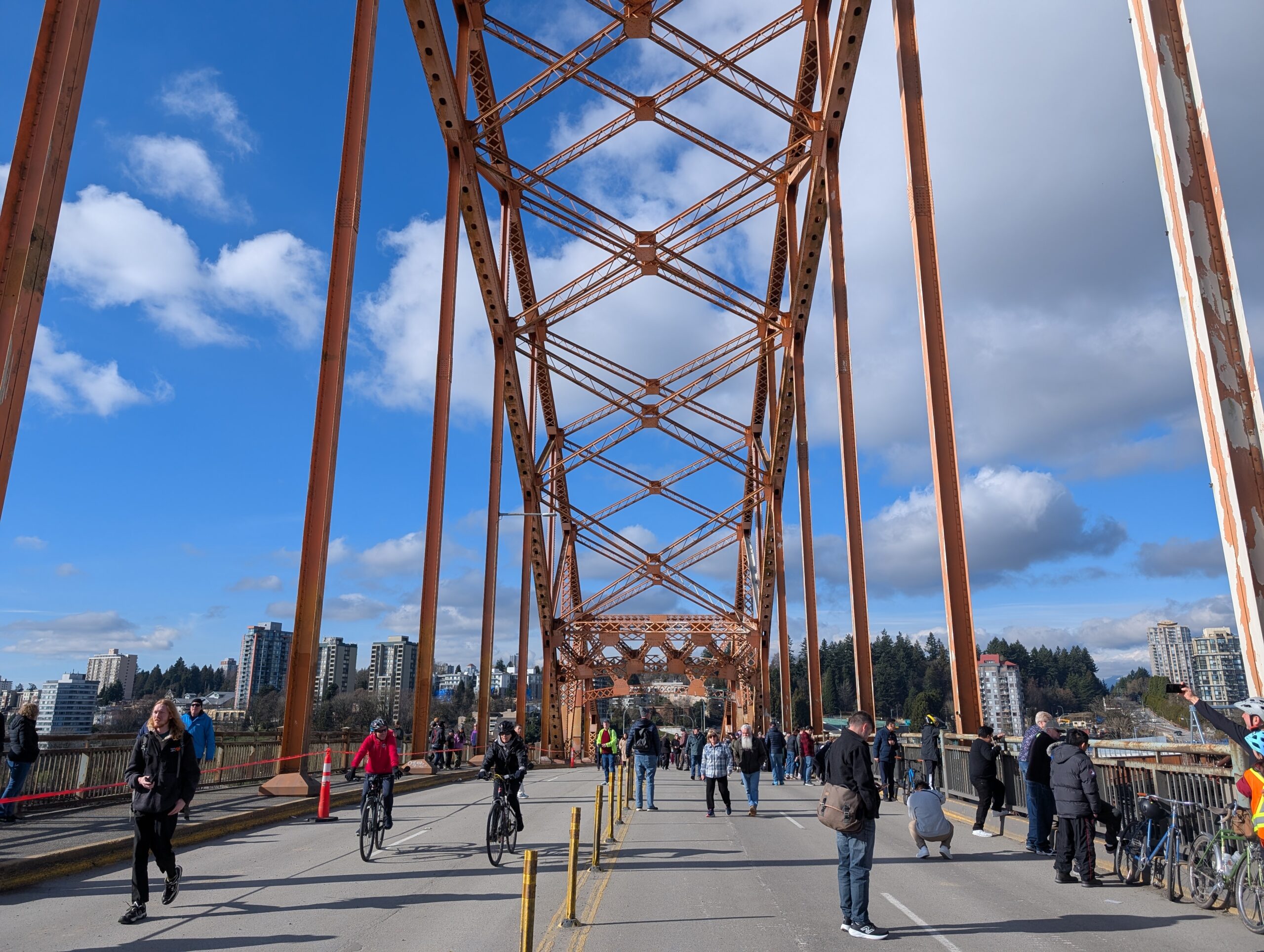
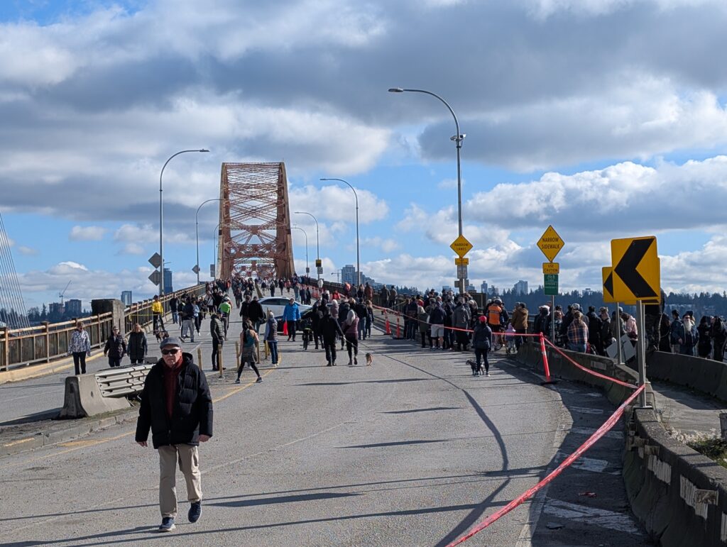
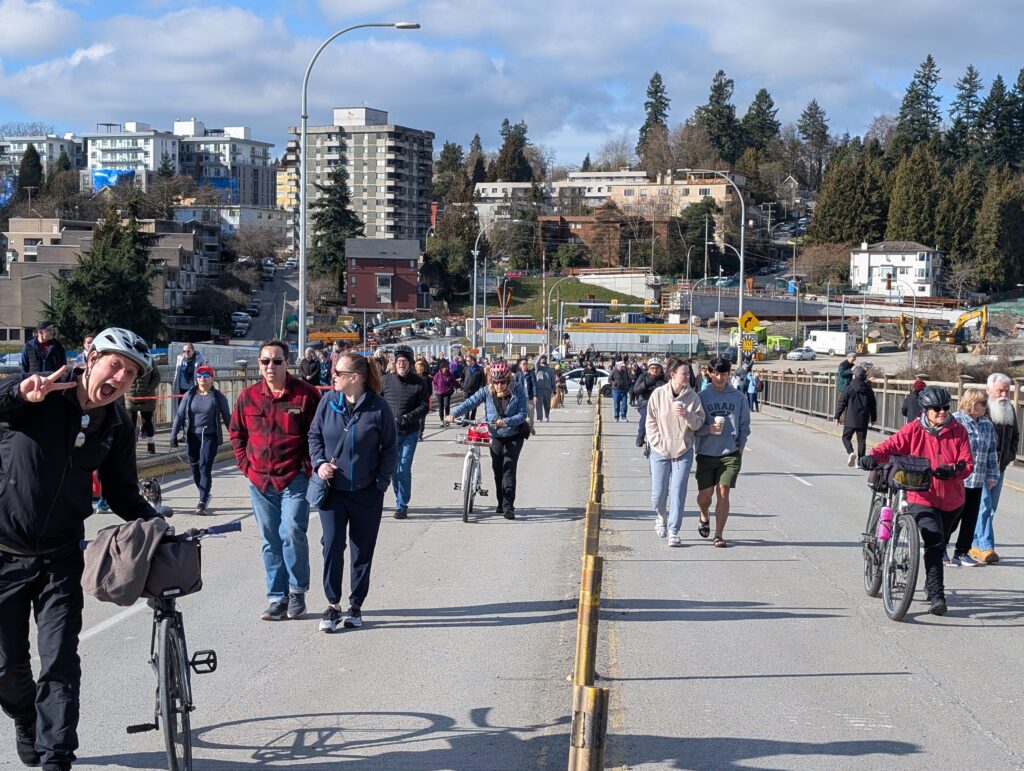
After a reasonably challenging ride yesterday, I managed to get out for a bit bigger one today (albeit flatter) to see off the Patullo bridge, whose decommissioning work begins in two days. A few friends were also interested so we met there, and apparently many others had the same idea – it was packed! They had a big line to get onto the bridge deck even, though that fell apart after a while (and I’ll admit I challenged it and ended up just cutting in). I think they vastly underestimated how many people would want to walk along a bridge deck in the sunshine on Sunday, knowing its imminent demise.
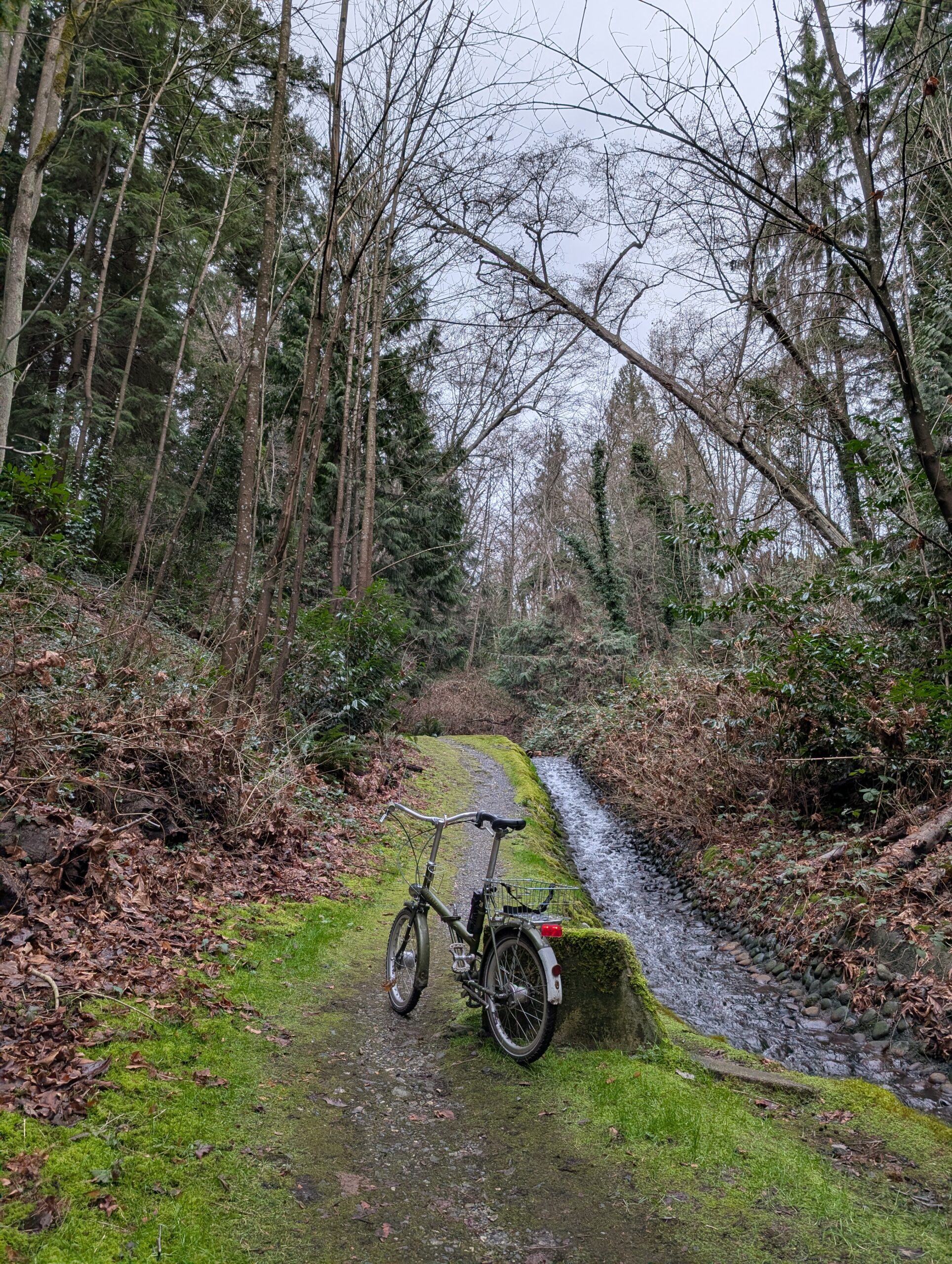
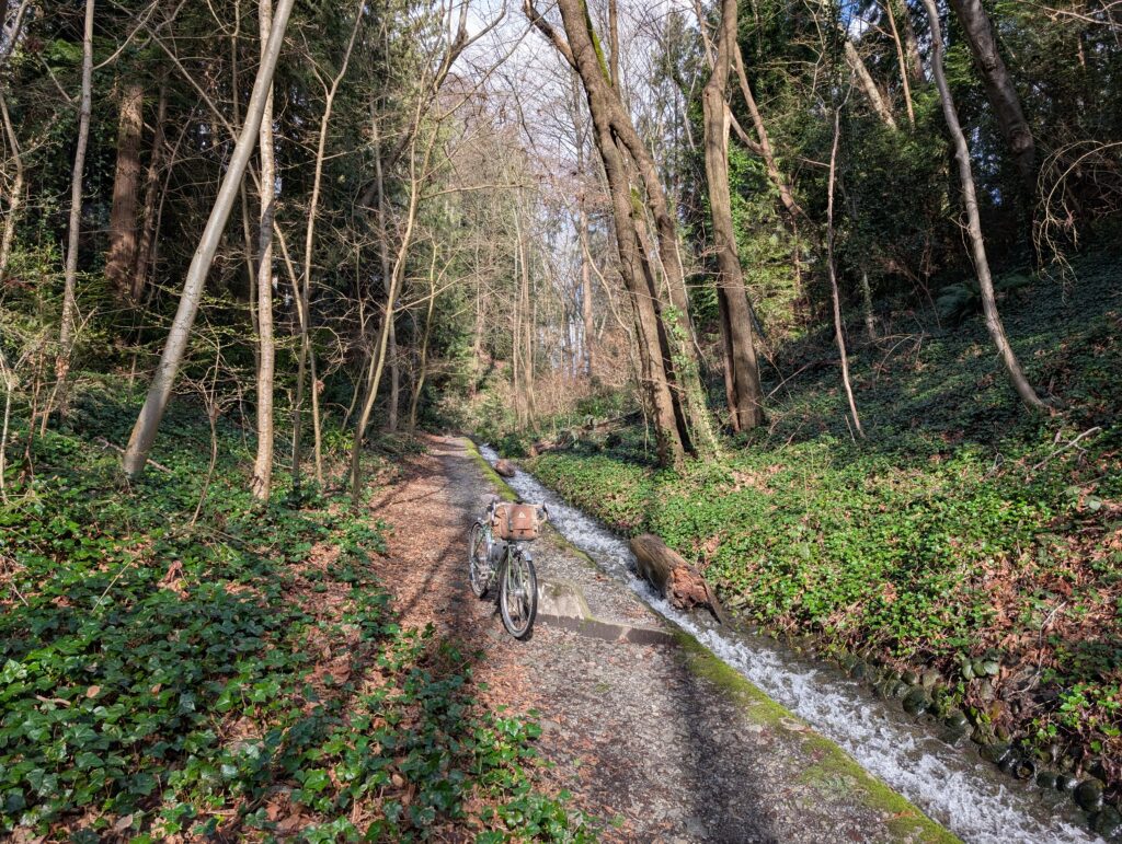
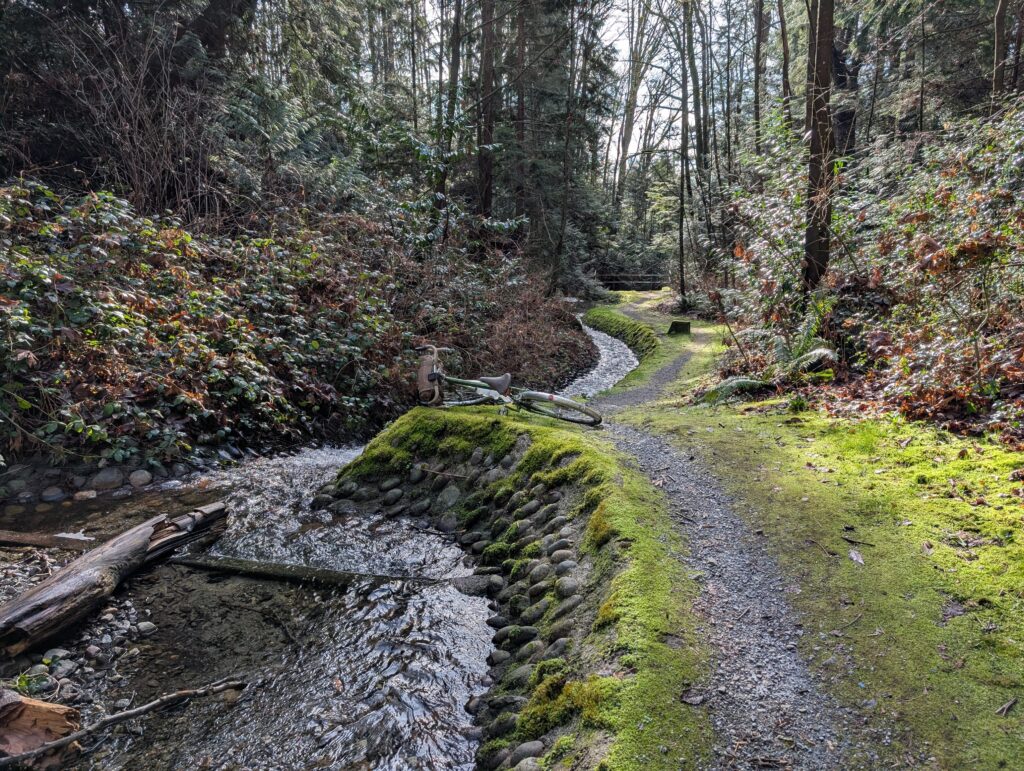
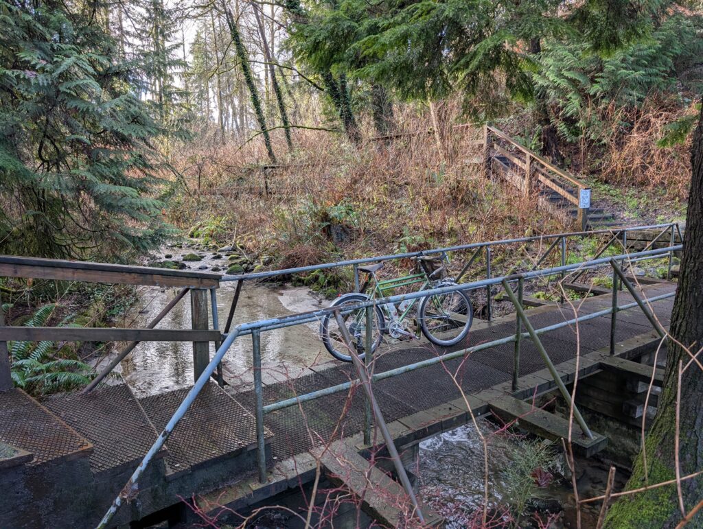
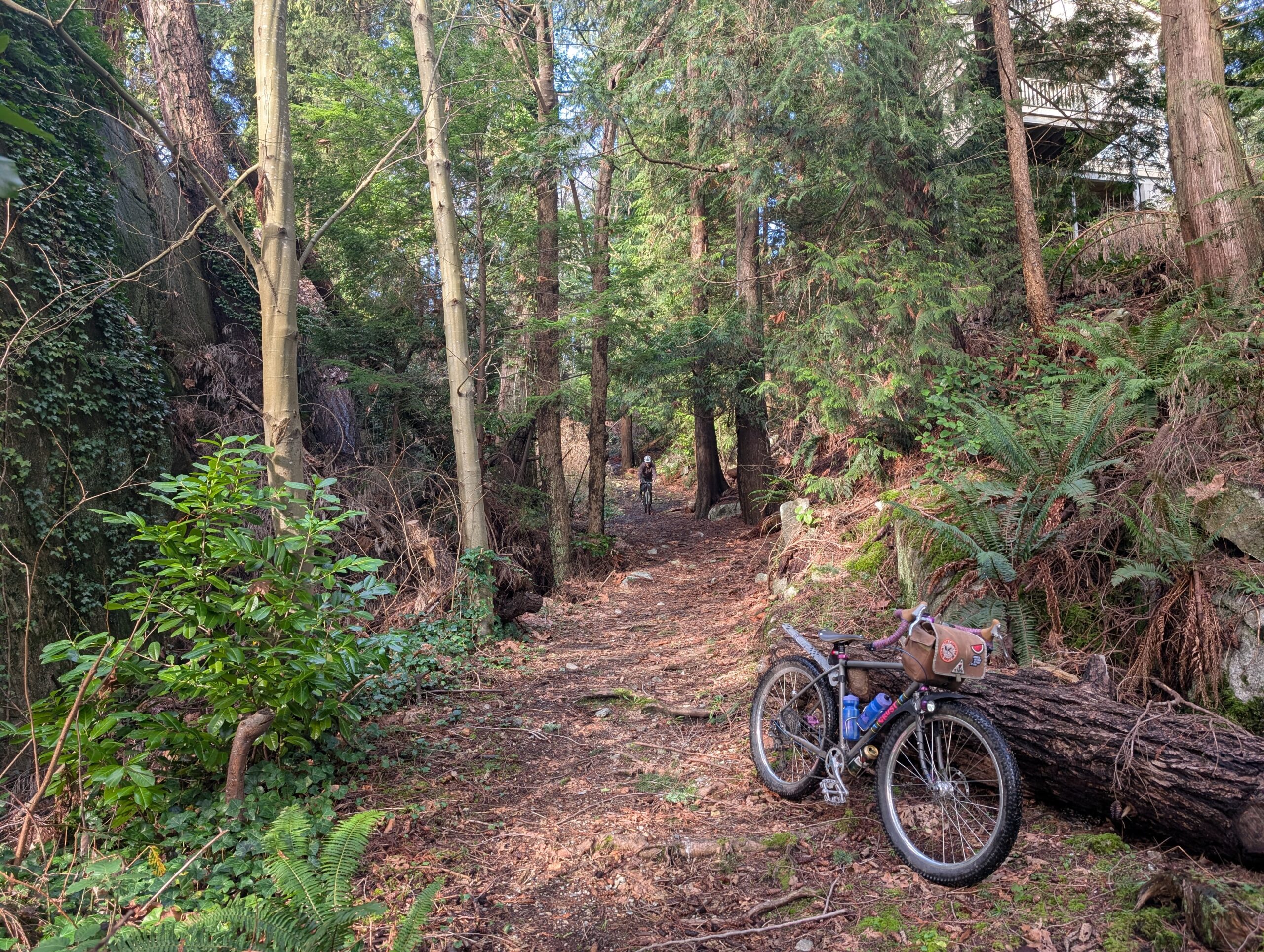
On the way there I took a bit of a meandering route so I could visit a few spots I haven’t been in a while. First was Kaymar Creek, pictured below. It’s a fairly short but sweet ravine, tucked away in a bit of a sneaky spot so few know about it – making it feel all the more special.
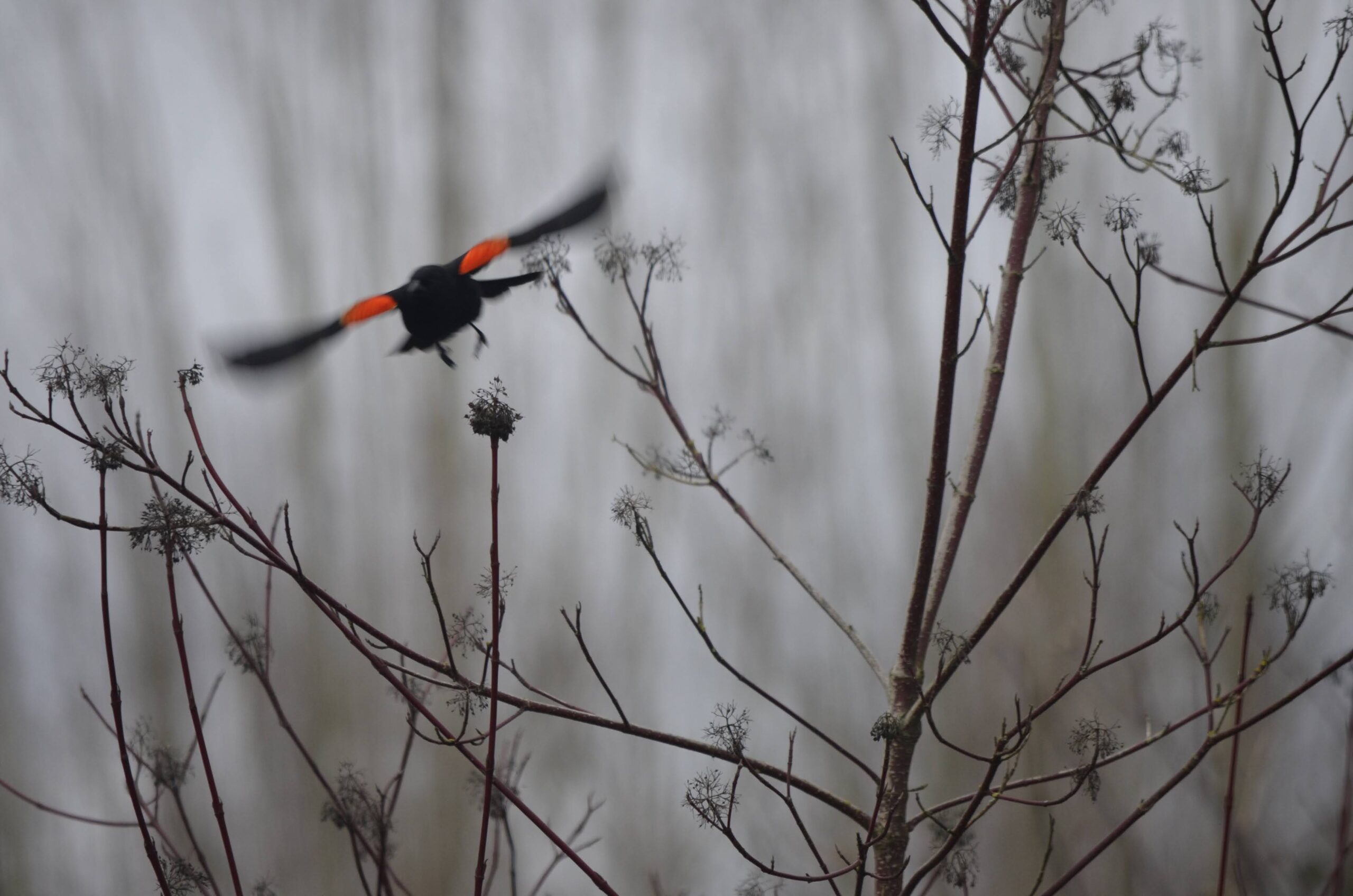
I also came across a flock of very friendly red-winged blackbirds, which for people out east is no big deal, but here they’re somewhat less common and I’d never managed to get up close to them before. Happy to check that off the list.
From there I wanted to check on a construction closure in Fraser Foreshore because it was a part of my Burnabop XL route but has been inaccessible for the past year and a bit. Turns out it’s going to be a while yet unfortunately.. large scale utility work going in. Guess I’ll need to plan the route accordingly – shame, this connection was rather wonderful.
A little while later we arrived at the bridge .. and I was floored by the crowds. I feel a little bit naïve that I was surprised – of course, on a sunny Sunday, the second-to-last day that it’s possible to walk the newly closed-to-cars bridge, it’s going to be popular. I guess word got out!
No photos of particular interest for the 25 kms from here to home, but once home I made a quick change to drive over to Burnaby Lake for a dog walk outing with my Mrs. Managed to fit in a ~60 min walk before it got too dark; an action-packed day for me.
Valentine’s Day was a sunny Saturday this year, and with plans made for late afternoon I was free to get some daytime exploring in solo. I set off to ride the latest iteration of the north loop of my route the Burnabop XL. Some of the most recent changes I had only ridden in the opposite direction so I wanted to check that it wasn’t too ornery to ride this way.
The above photo was taken about 15 km into the route, next to the local velodrome. The skies were moody and it was cool out, but rain was unlikely. The next section was Velodrome Trail, a hilly but beautiful stretch of trail along the north face of Burnaby Mountain. One of my favourite things about this trail are the massive big leaf maples in this area, including the specimen below. I dragged my bike down to the base for scale – it’s trunk is 5 to 6 ft diameter and must place it near the top of big maples in Canada. The biggest ones in Canada are in Stanley Park and I’m keen to compare.
The sun came out properly while I rode along Trans Canada Trail along Barnet, below. Most cyclists take the adjacent road because it’s quite a bit more efficient, but unless I’m desperately pressed for time you’ll find me down here on the much more pleasant trail.
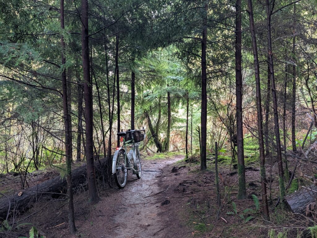
A rather low traffic gem of a trail, Hang Your Hat, is closed with no indication of a long term plan. I’m glad I’ve ridden this trail as many times as I have, because I fear they won’t bother to replace the rotten bridges. It also features a viewpoint that feels like a secret because it’s on an even less-used side loop.
The Trans Canada Trail section ends once you reach Port Moody, and from there it’s a 75m climb along the spine between two ravines, a trail that isn’t well known but is definitely well rutted.
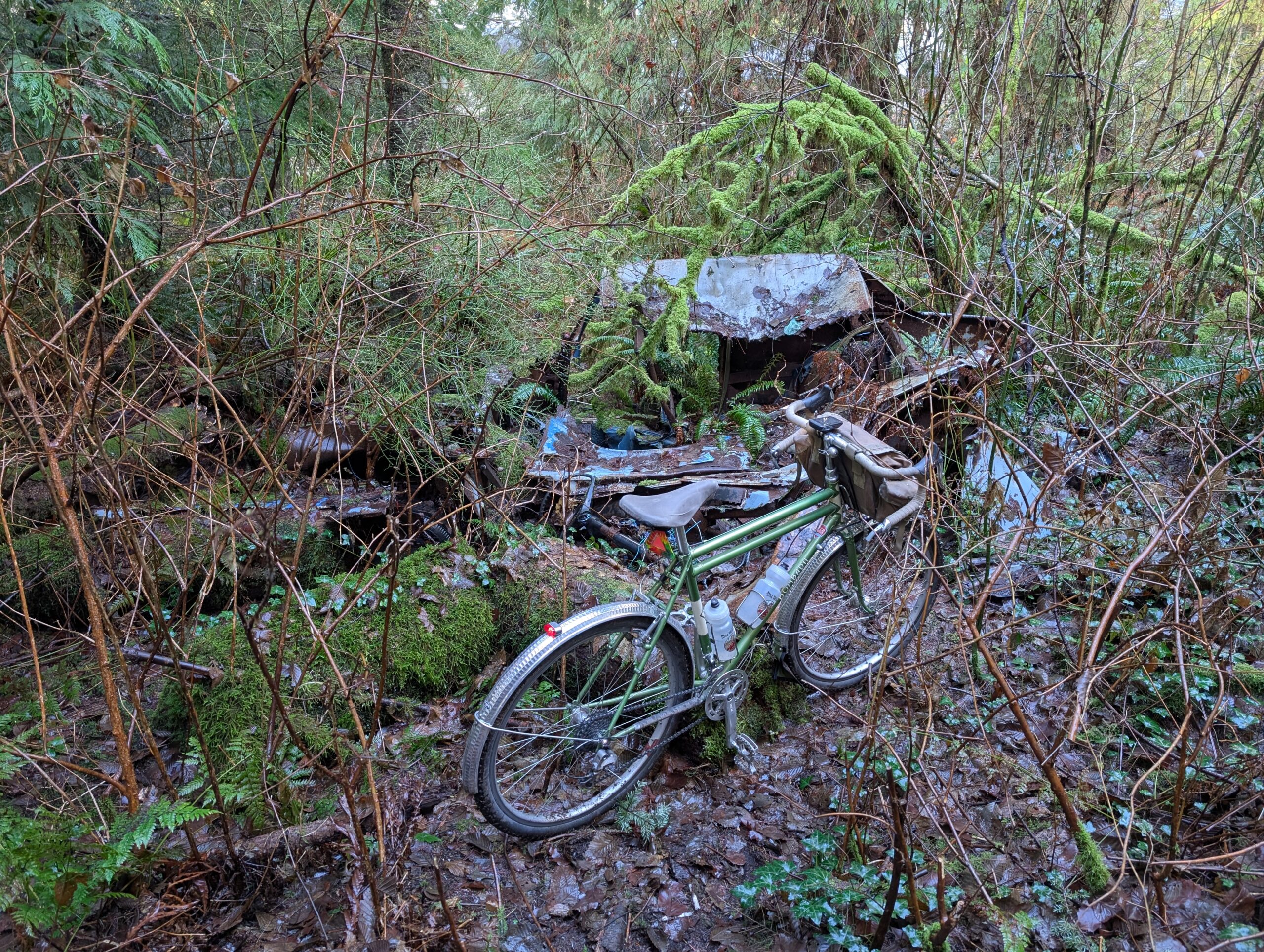
Something I didn’t notice previously, having only ridden the trail in the opposite direction, was this car that’s been largely reclaimed by the forest. It’s only about a block away from existing roads, but hard to imagine how it got here nonetheless.
The climb was hard but not too long. There were a few blocks of neighbourhood roads and then a boardwalk crossing of the adjacent ravine. Not very bikeable, but a lovely natural area. Lots of birds to listen to.
After that it was more popular paths and a stretch of notoriously muddy trail that really delivered on that promise today. I stopped at Dageraad Brewing for two small pours before my regular neighbourhood noodle home from there.
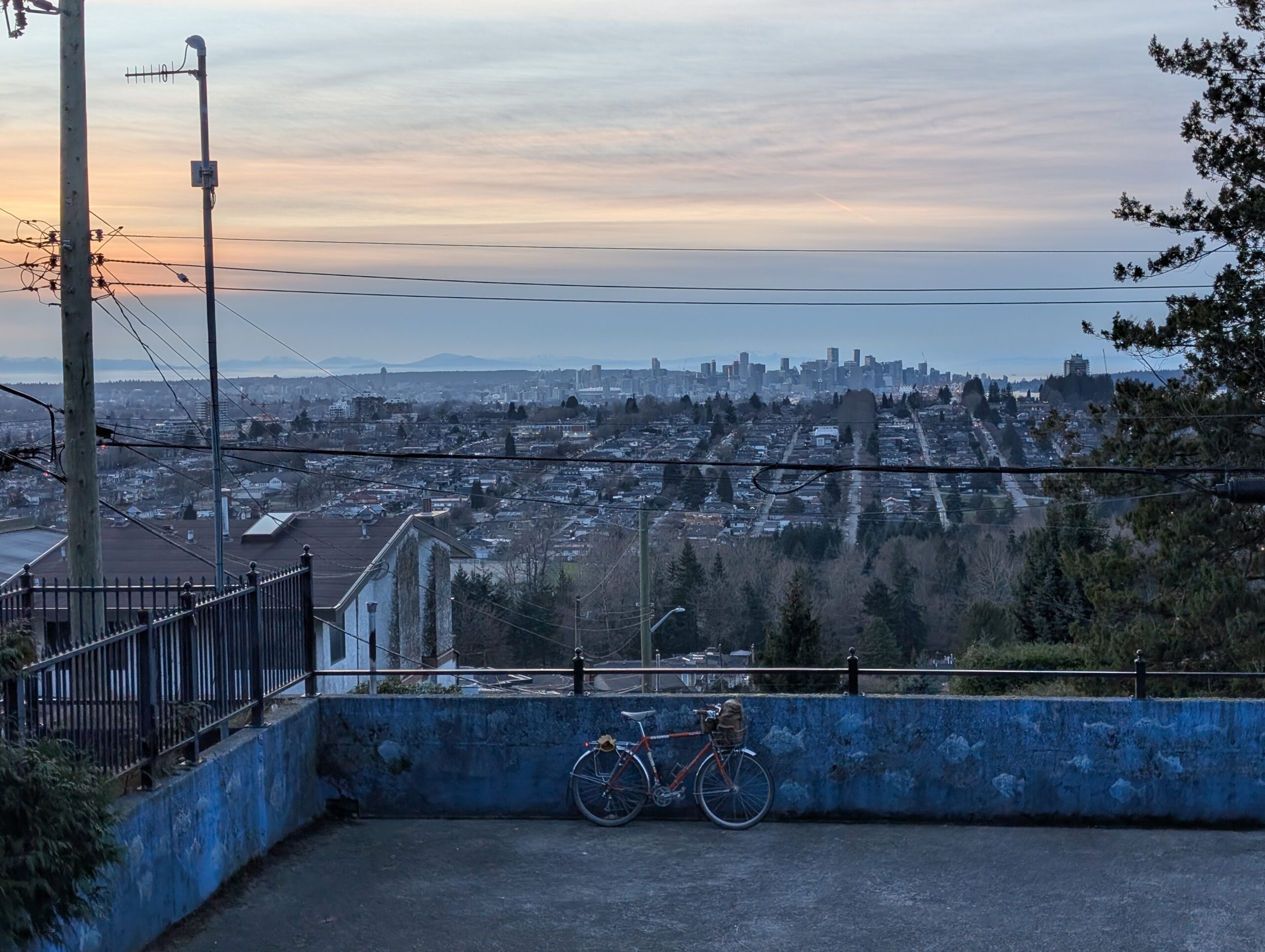
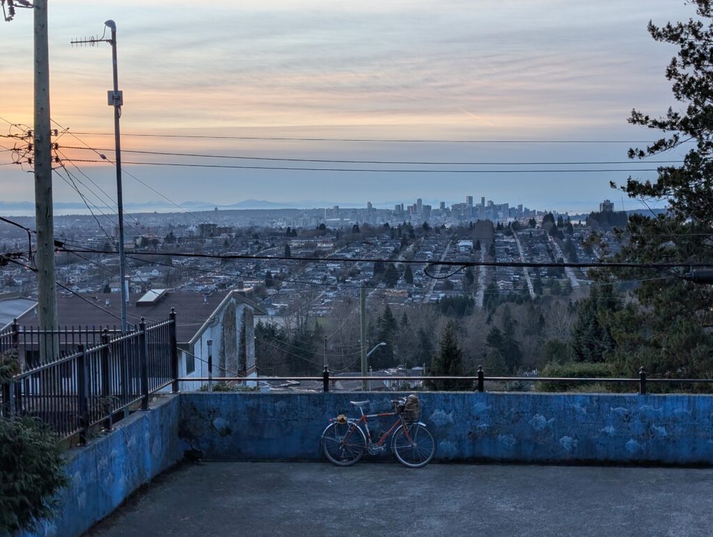
It’s been alternating wet and dry days lately. On Monday I commuted in the rain to work (though got home in a dry window), of which I’ve no complaints as it was a balmy 6 or 7 degrees Celsius. Today was sunny and cool, and I started work (from home) a bit early so I could get out on the bike in time to ride up to my favourite sunset spot before dark.
Said sunset spot below. This is Capitol Hill Reservoir Park, for anyone local who might be reading and curious. I took the direct route here, which is a brutal climb of 15+ percent grade, but it gets you there quick.
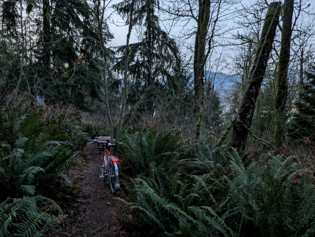
On the way back I had in mind the trail network on the north slope of Capitol Hill, which is a confusing web of trails that are lovingly maintained by the locals. A group known as the Capitol Hill Tree Keepers, who’ve put up signs on old stumps with information as well as made a cute little social space in the woods complete with chairs and tables, as well as labels for the various native plants surrounding it.
Some remaining sunset awaited me once I got out of the woods (so to speak, but also, literally). I’m very curious about this road, which is gated in the distance and has been left to be slowly consumed by the forest. It’s a rare example of a development opportunity not being taken, and I love to see it.
Caulfield is one of the most west, and most expensive, neighbourhoods in the already very affluent West Vancouver. It’s along the steep rocky bluffs near Lighthouse Park; so steep and rocky it’s quite a feat that roads were able to be carved into the hillside, let alone the impressive mansions dotted between the trees. A lot of the most notable architect-designed homes are in this area.
Caulfield is perhaps less known for its network of little trails connecting up various dead-end roads, but that’s what’s most note worthy for me. These little trails tend to be locals-only knowledge, and the neighbourhood pride is evident in their maintenance and construction.
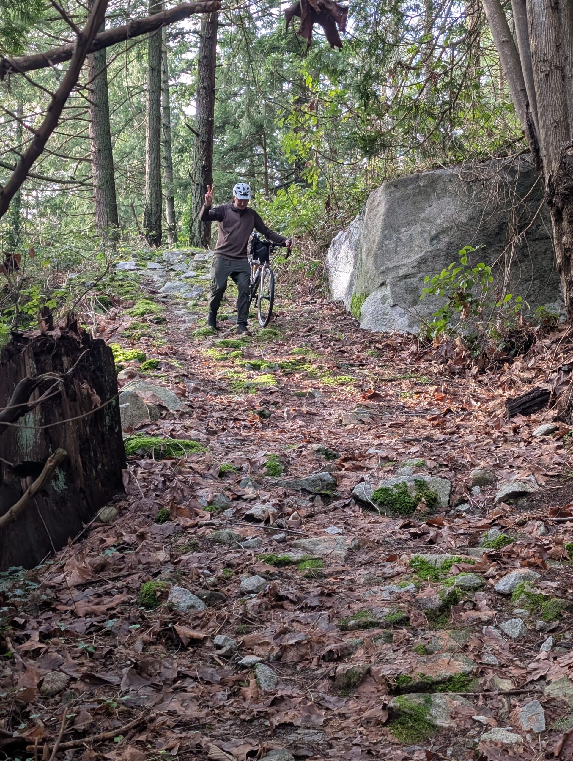
I’d already checked out a good number of them previously, but some remained unchecked, so I gathered my always-up-for-a-hike-a-bike pal Rob and we headed west.
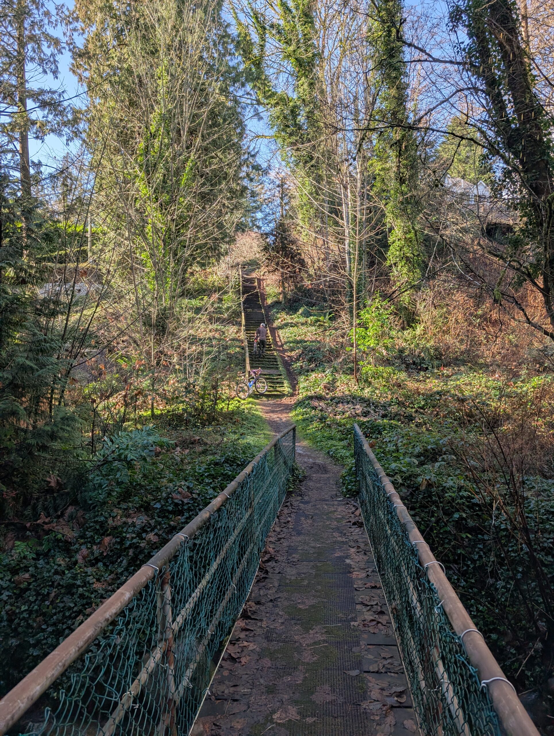
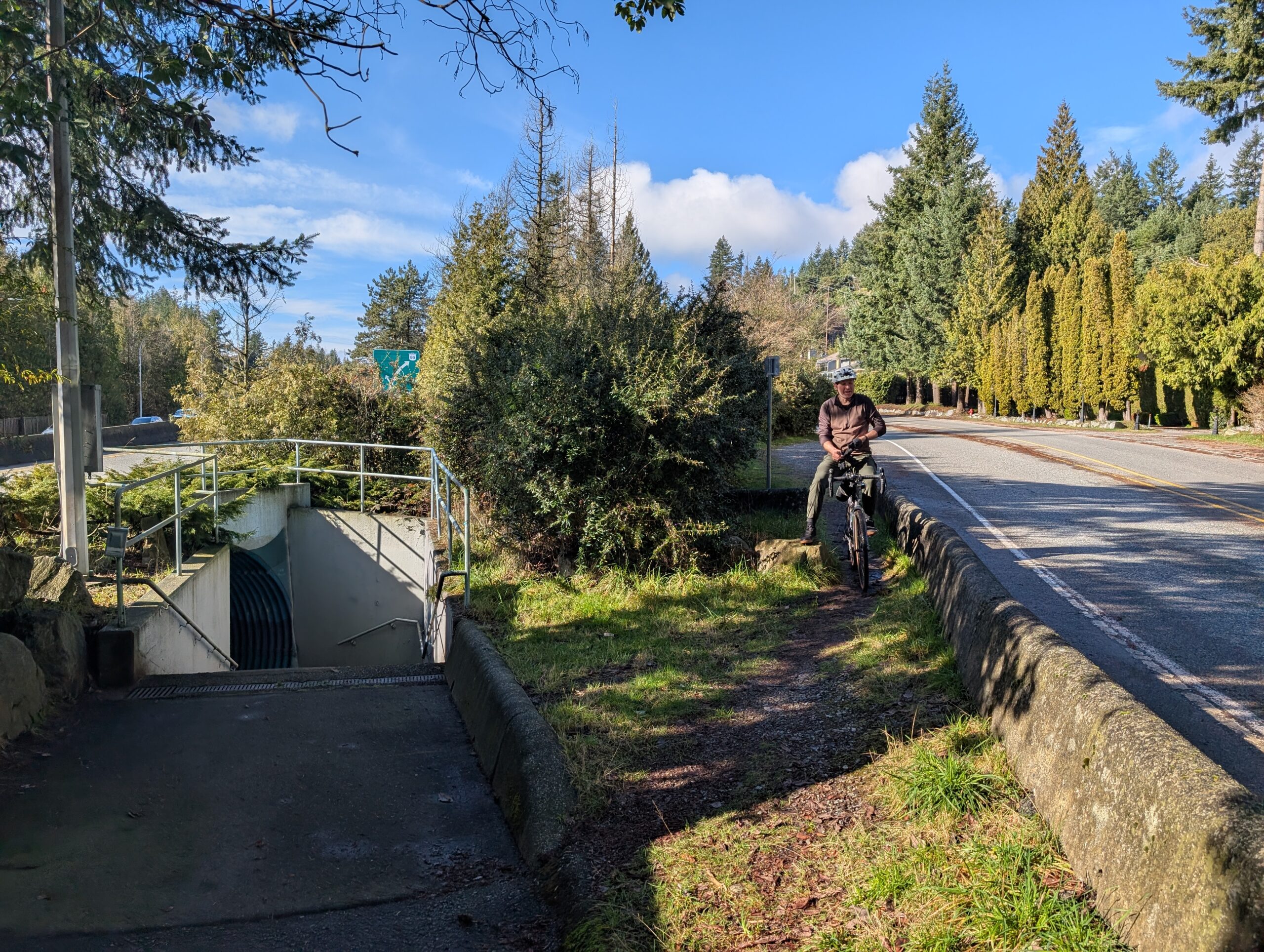
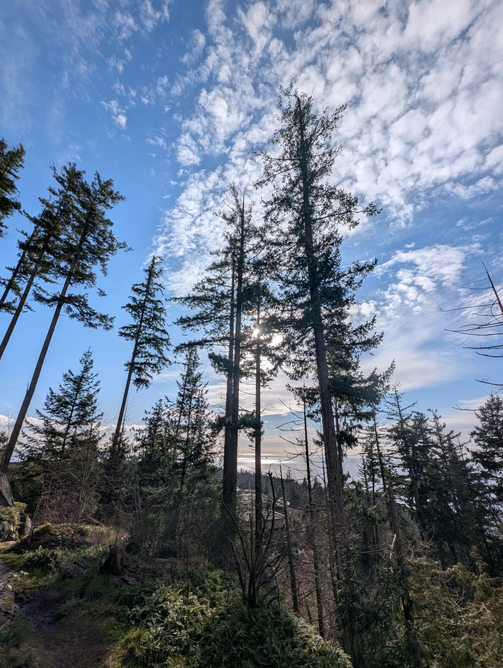
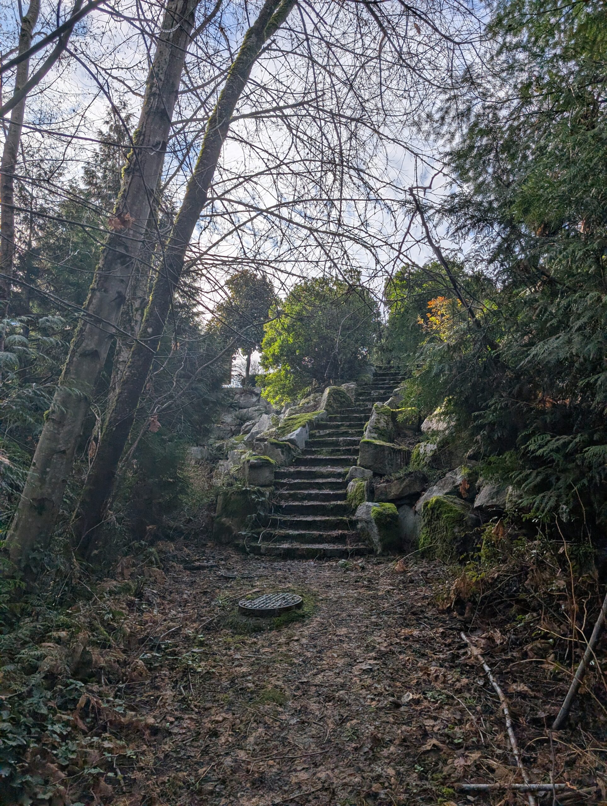
The first 20 km were nothing new, and I didn’t take photos. The staircase top left I had recently climbed, and I’ve posted a photo of on my blog I believe – it looks a little bit brutal, but isn’t too steep so it’s not bad at all. The stairs top right were in Plateau Park, a descent of 70m that were decided not to do – and thank goodness, because we’d have missed out on the highlight of the trip.
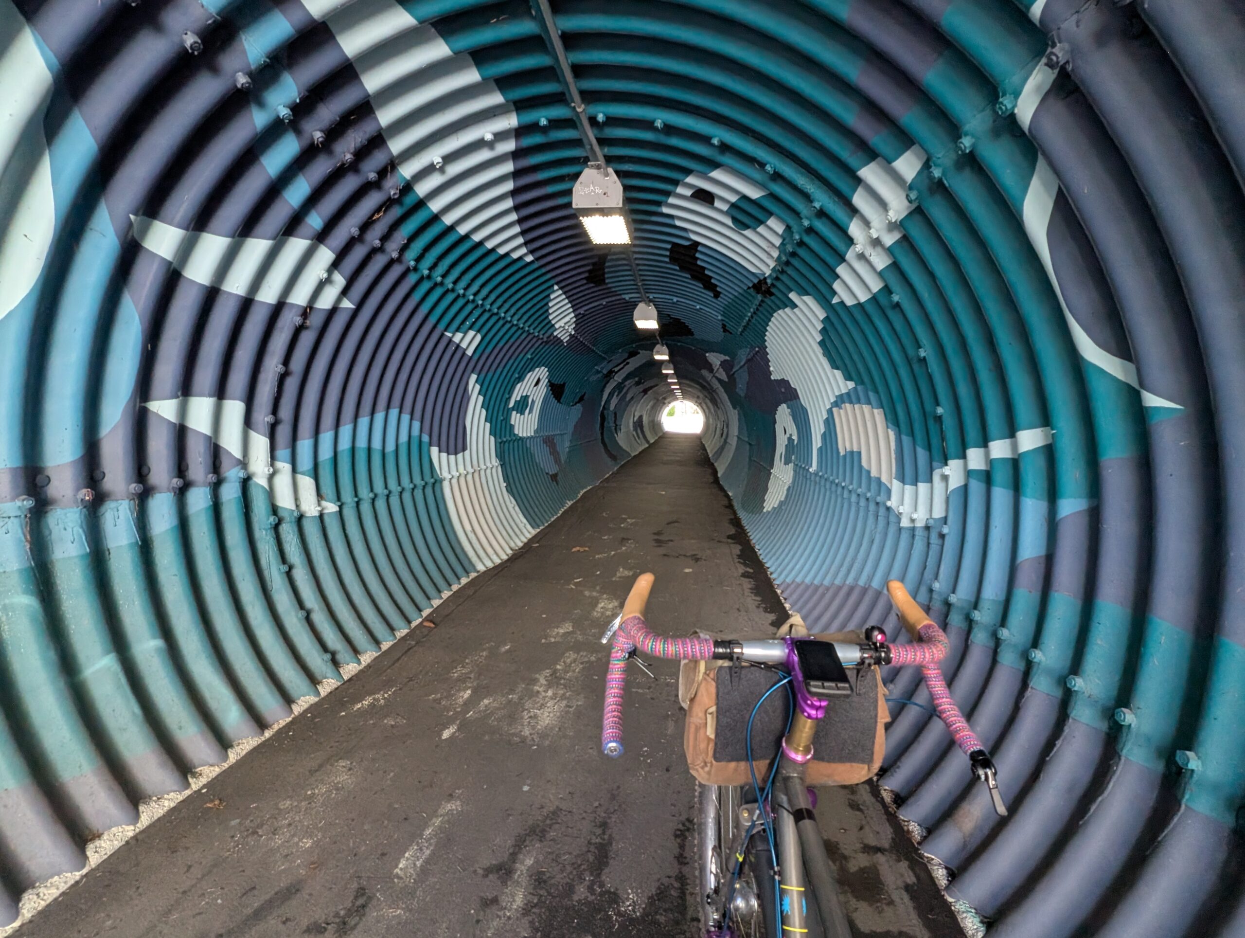
Between the two above staircases was this tunnel, below. The street it’s on is a bike route, one I’ve taken many times, but this tunnel is very well hidden and it’s very unlikely anyone passing by knows about it by sight. Its purpose is to connect the homes on this side of the highway with the school and strip mall not too far away on the other side of the highway.
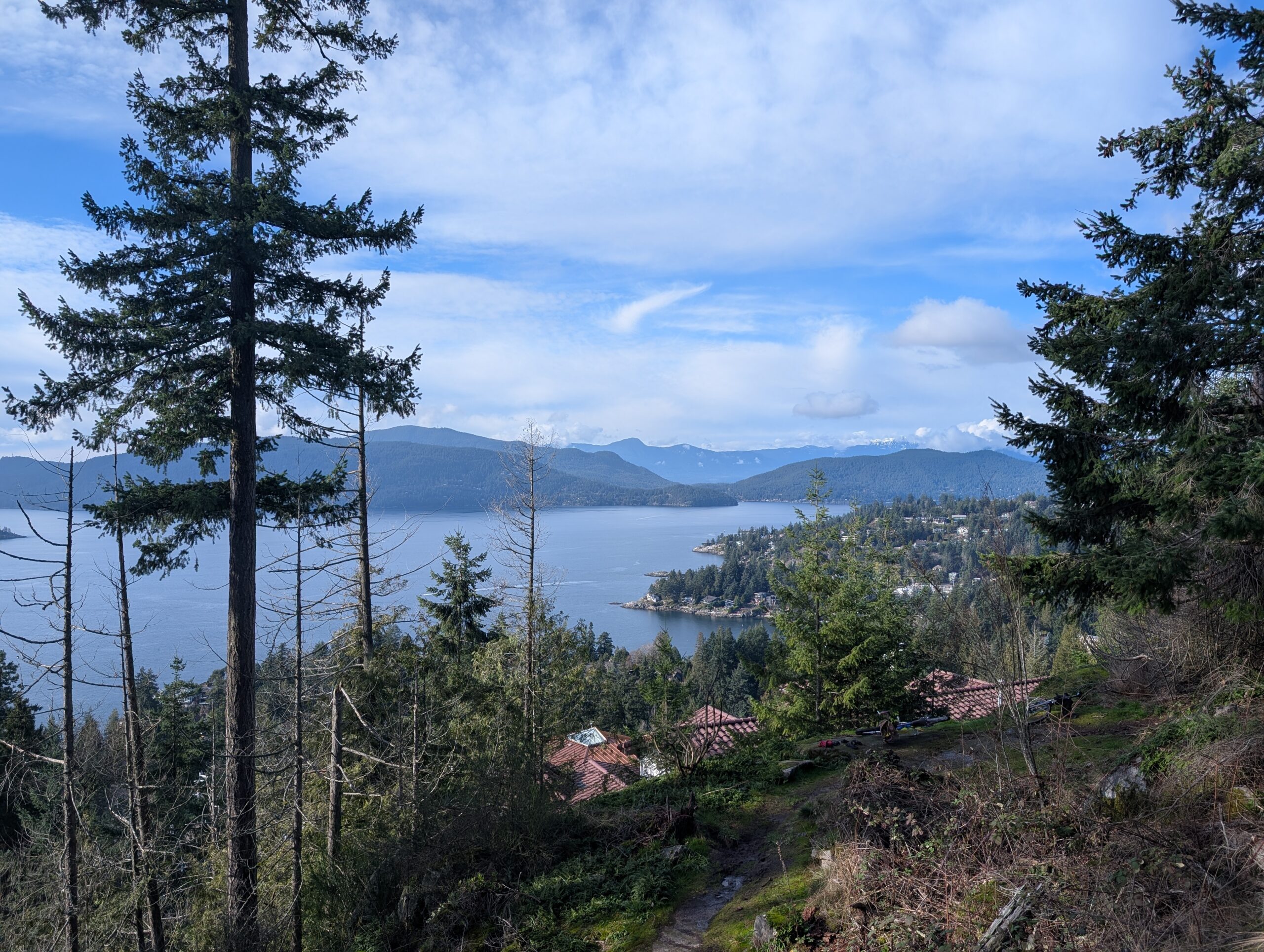
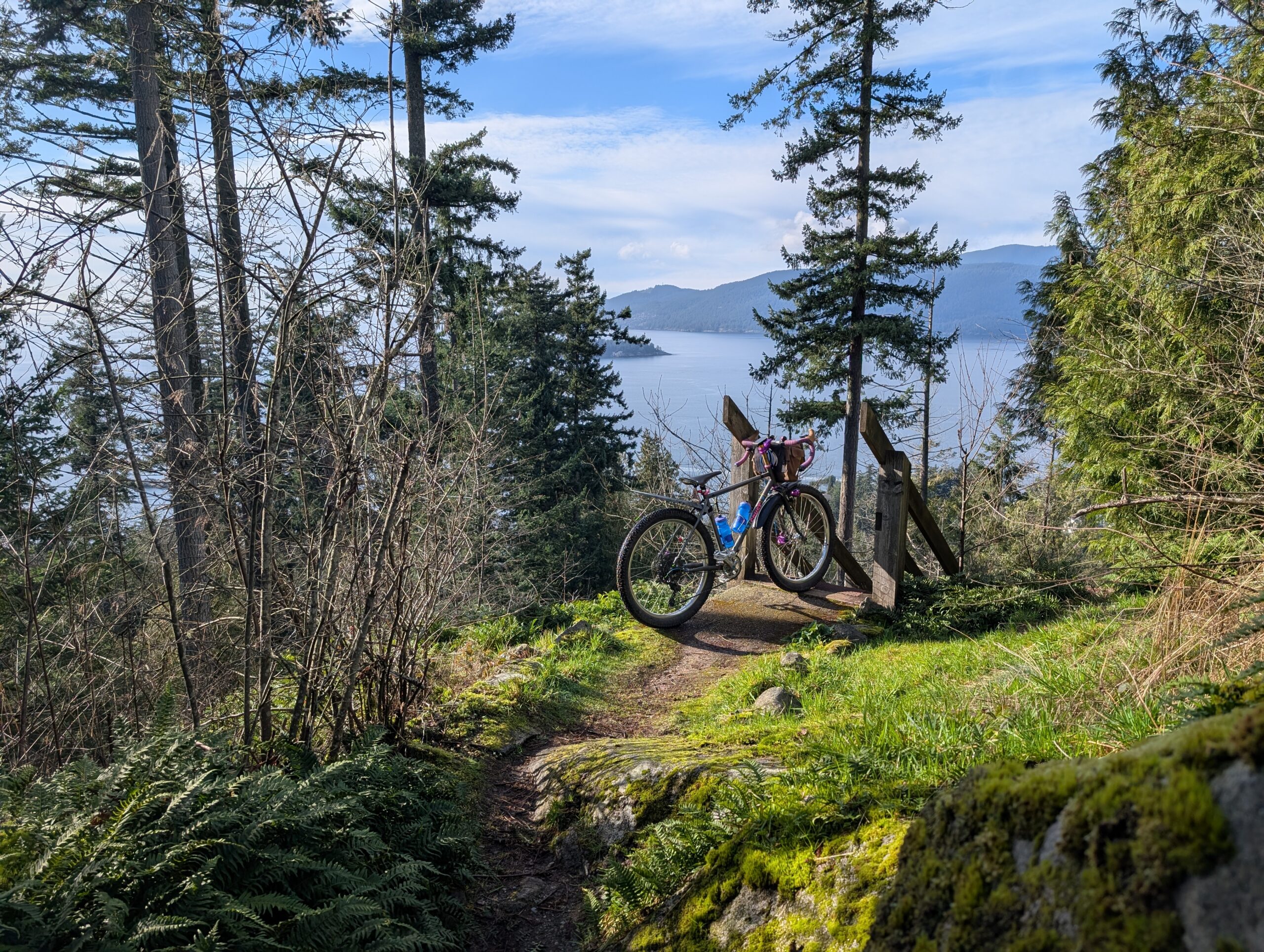
Instead of that 70m descent through Plateau Park, we followed the street a little further to a couple other short trails we’d noted on Open Street Maps. At the viewpoint below I knew we’d make a good call. To make things significantly better, a group of 8 or 10 eagles were circling above us and putting on quite a show. Neither of us, nor the locals who passed through, had ever seen so many together.
These bluffs were also home to some extremely tall, slender trees. We spent about 40 minutes here, soaking in the views and nature, and enjoying a pilsner each.
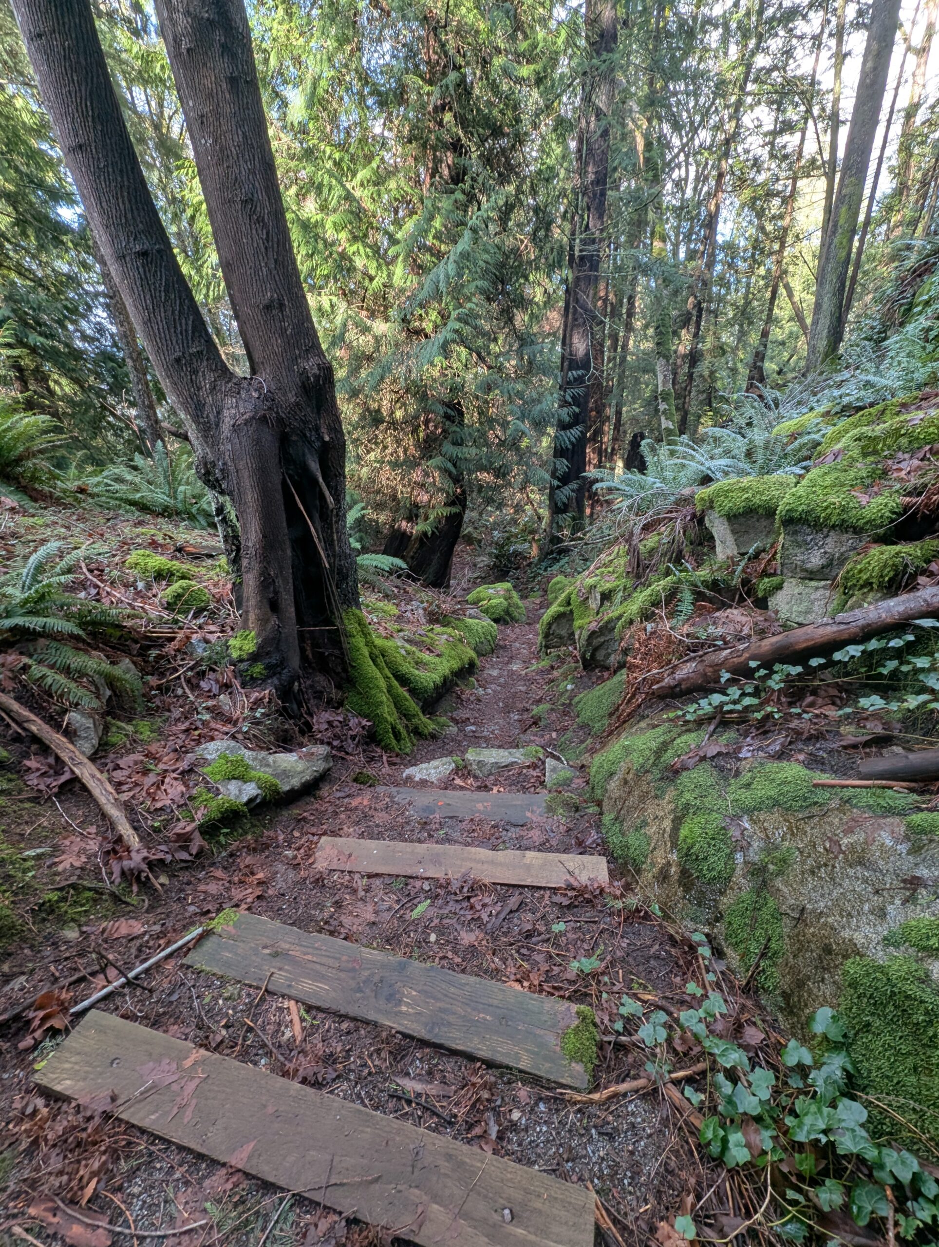
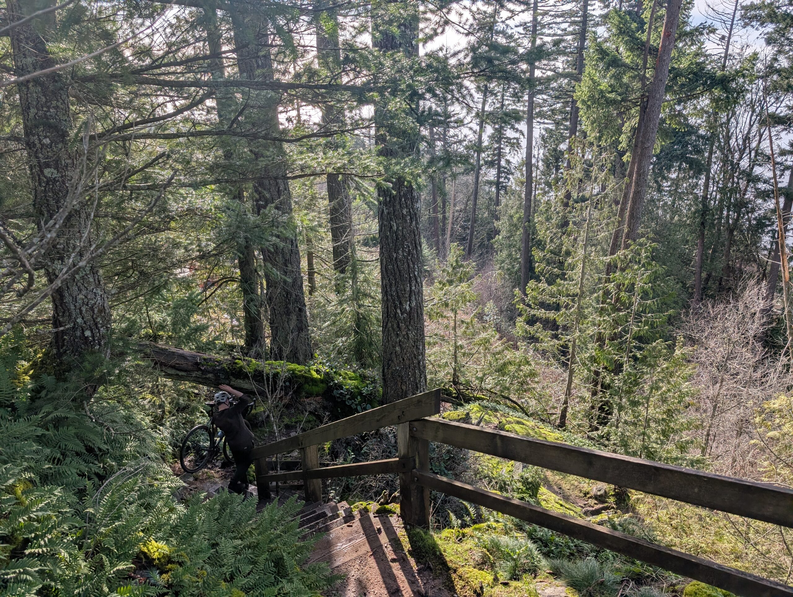
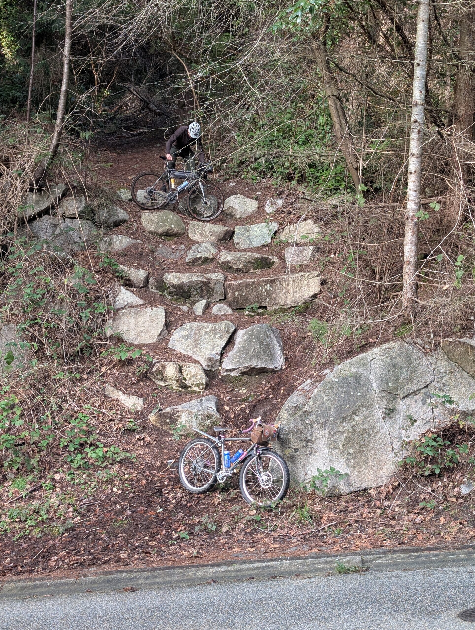
The beautifully constructed stone staircase above was something I noticed by chance just after we’d gotten back onto a paved road – it wasn’t the direction we were planning to go, and it was obvious from the start we’d lose a lot of elevation – but it was much too enticing to not check out. It wasn’t showing up on our map either!
It was wide and well graded, but clearly abandoned at some point. It also got steeper and steeper until the comical exit to the road – a literal scramble down a series of retaining rocks. I have to imagine this trail had a clear vision at one point, but I’m not sure what the plan was at the bottom – perhaps some switchbacks?
Regardless, it was a really fun little connection that actually ended up re-connecting to our original route without much fuss. The rest of the ride, of which there was plenty remaining, was much less note worthy, though just as pleasant. I took some muddy trails through Stanley Park and connected with friends for the seawall ride home.
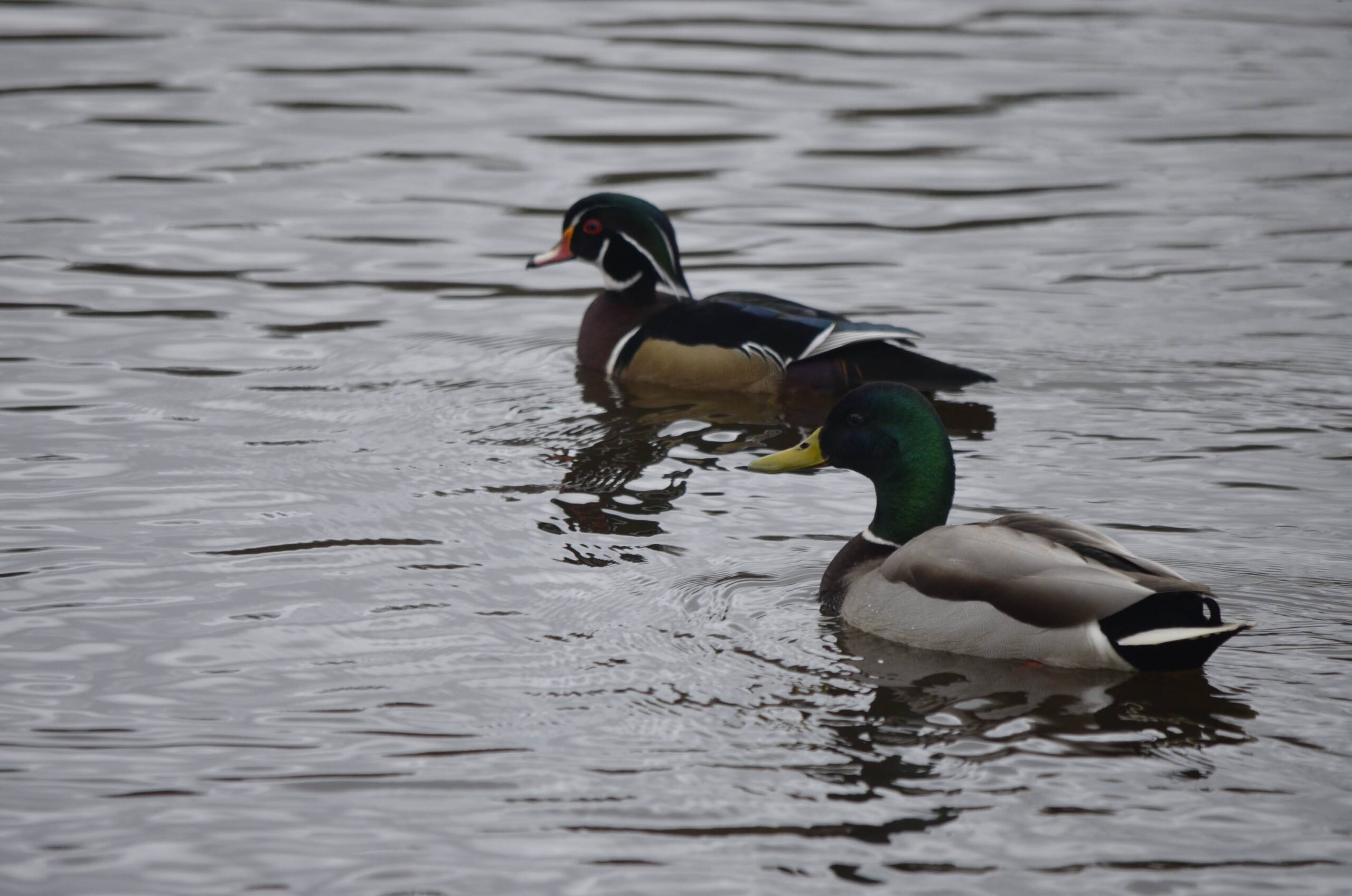
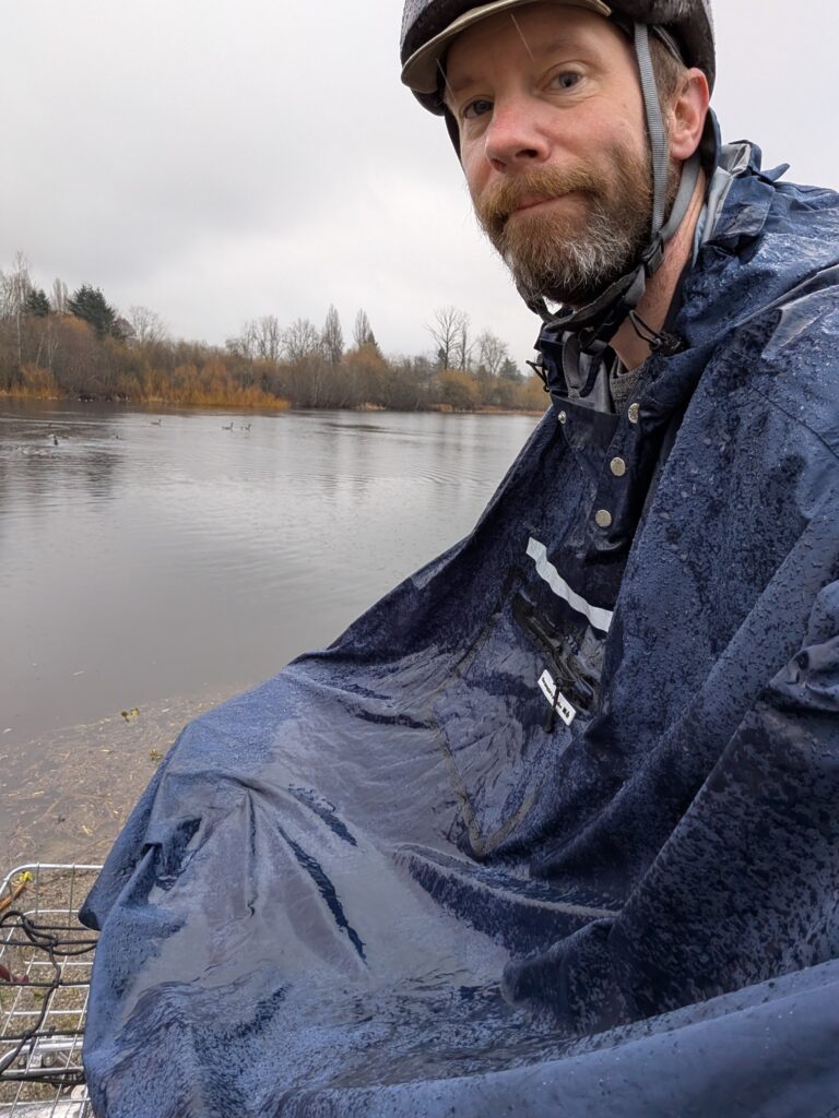
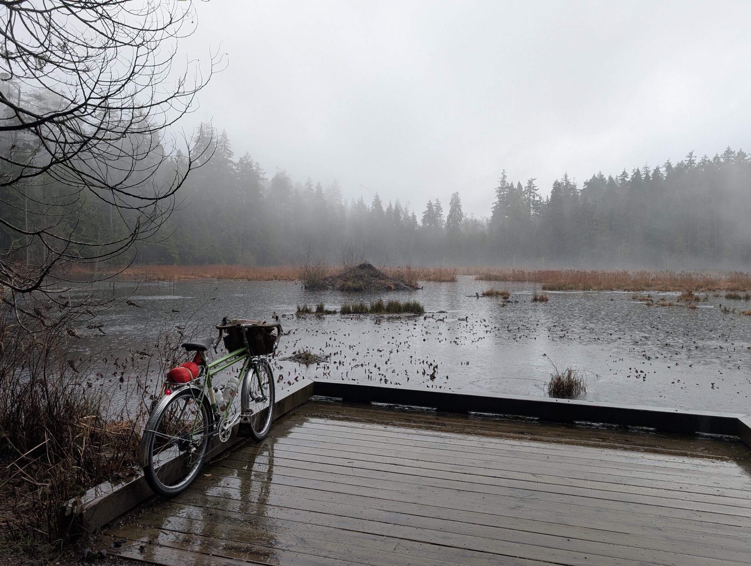
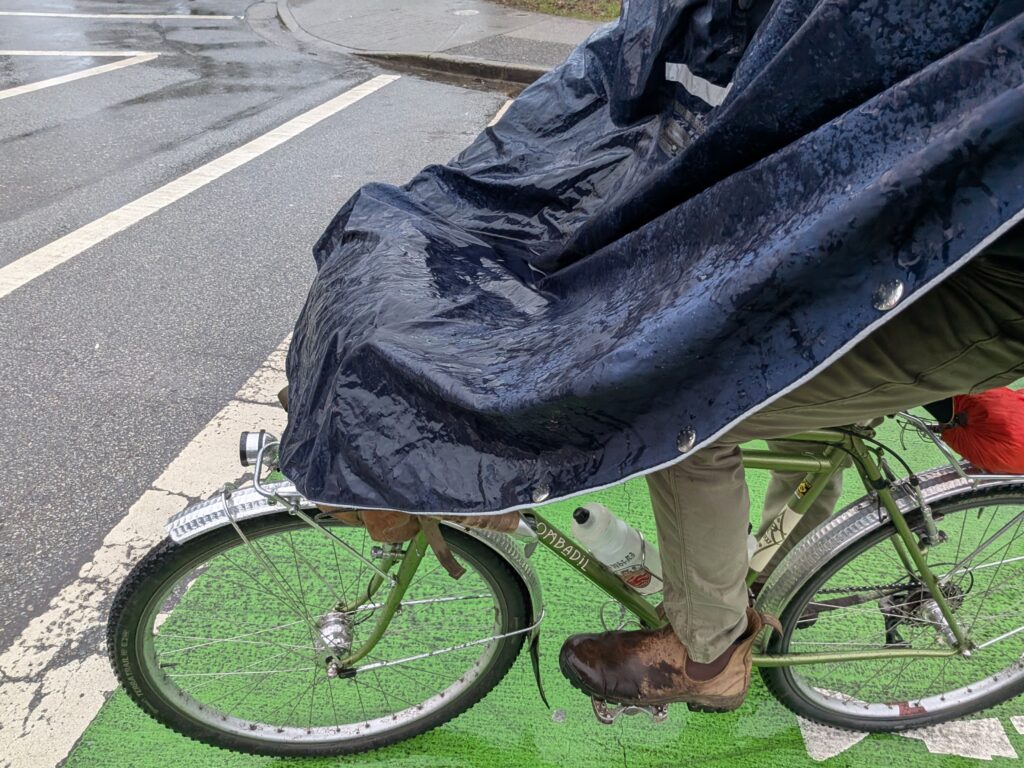
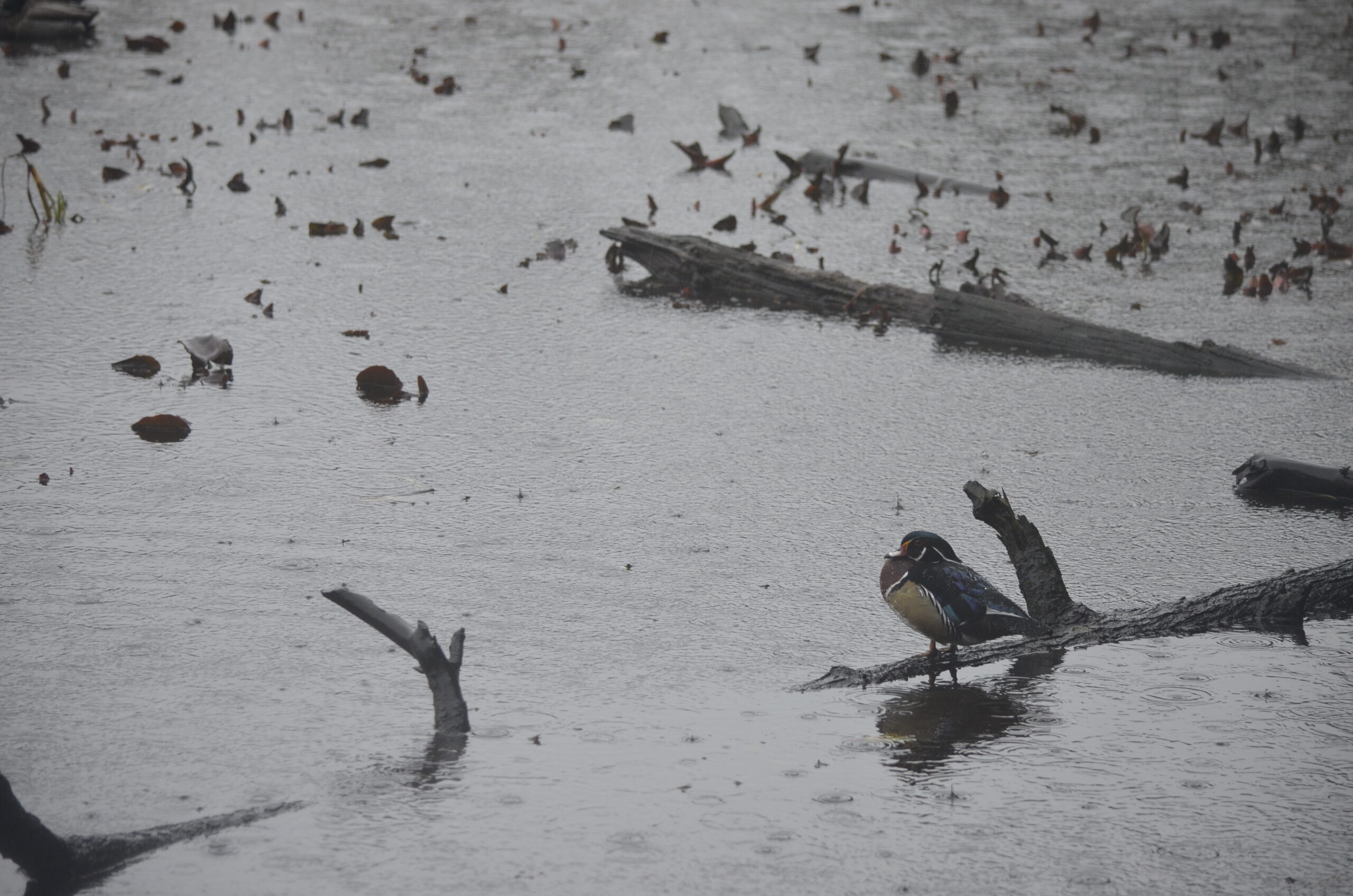
Today, Saturday, was forecasted to be what we call an atmospheric river these days. Tomorrow is looking more or less dry. Yet I don’t sit still very well, so I put on the poncho and headed out with my camera to try to get some more bird photos. The photo below is from my phone though, overlooking Beaver Lake in Stanley Park. I did get some “real” photos here too of a snoozing wood duck among the many mallards.
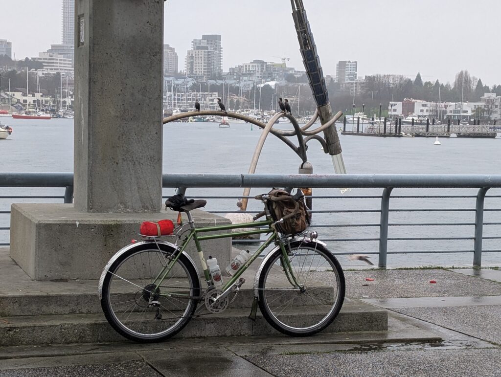
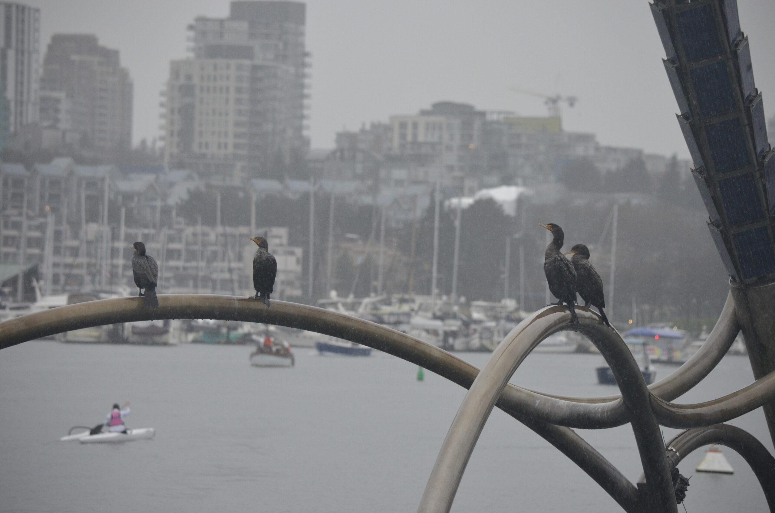
Another phone photo of four cormorants watching the kayakers along false creek inlet.
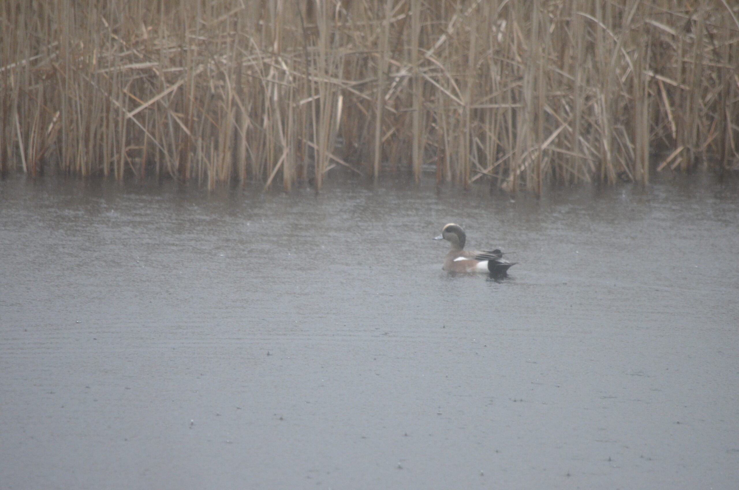
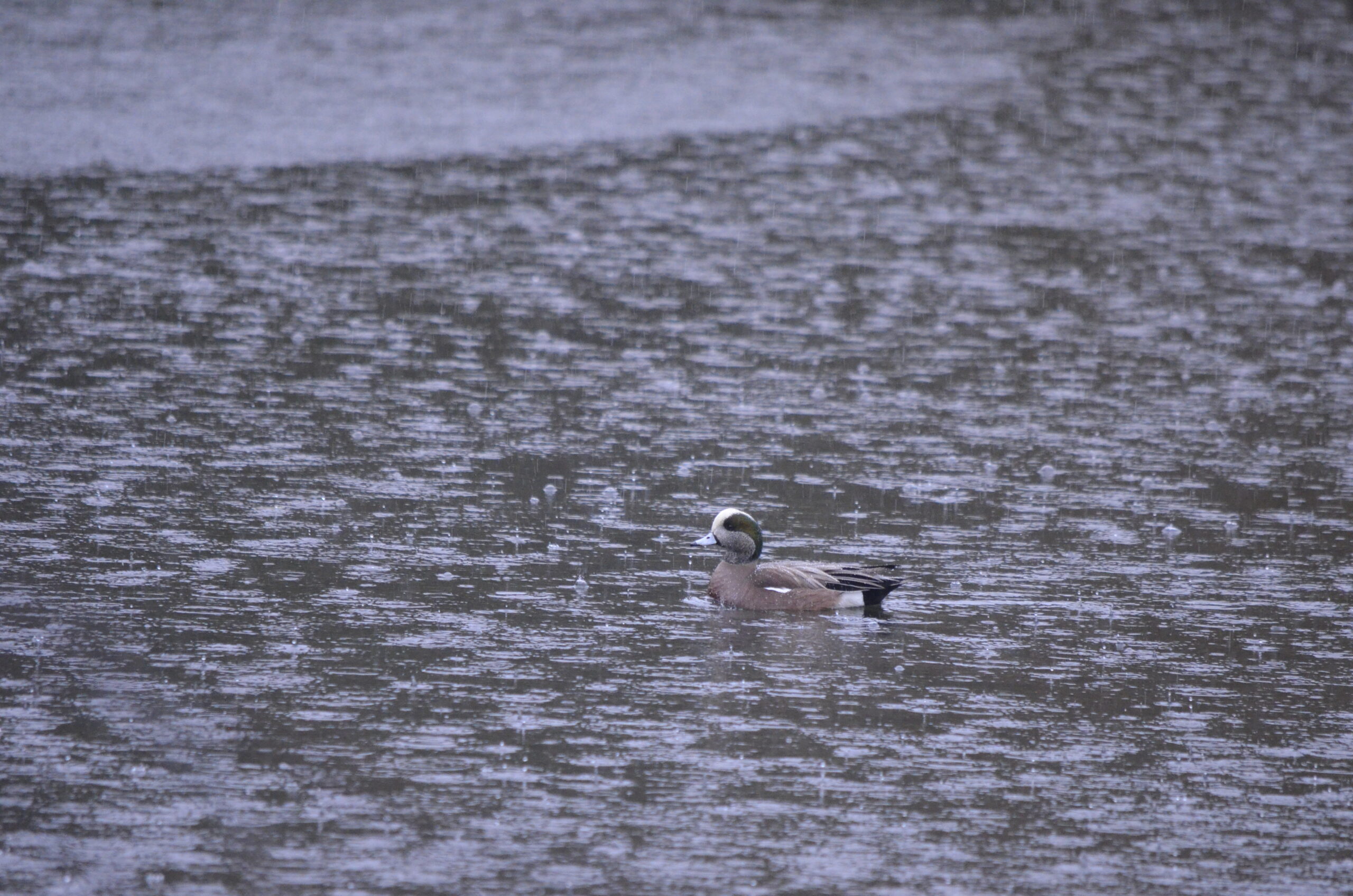
Riding through the forest in the rain is quite lovely, but I had it in my mind I’d go get some water fowl photos at the pond at Ambleside Park, known for a good selection of birds. My poncho did a good job for a while, but the rain and wind both picked up and left me pretty soaked after a while.
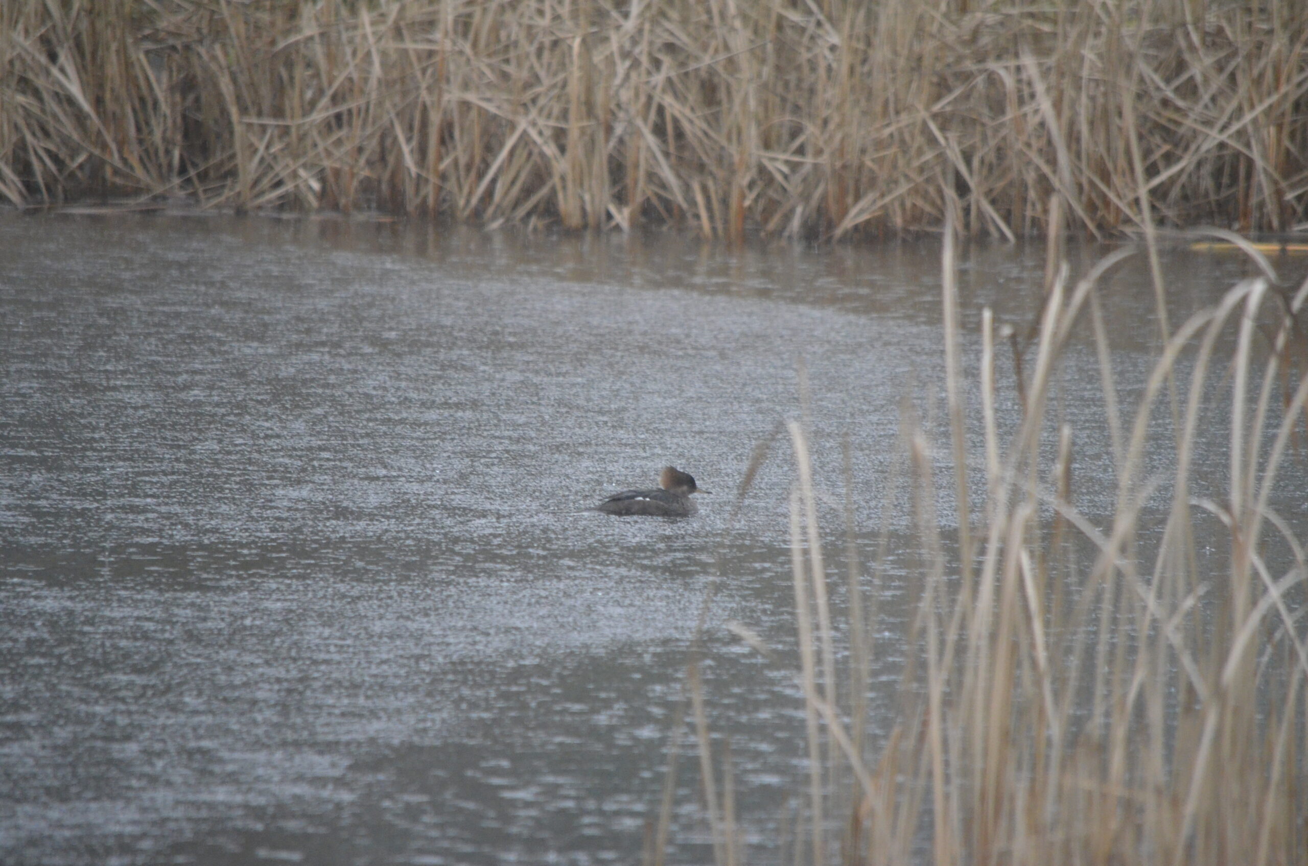
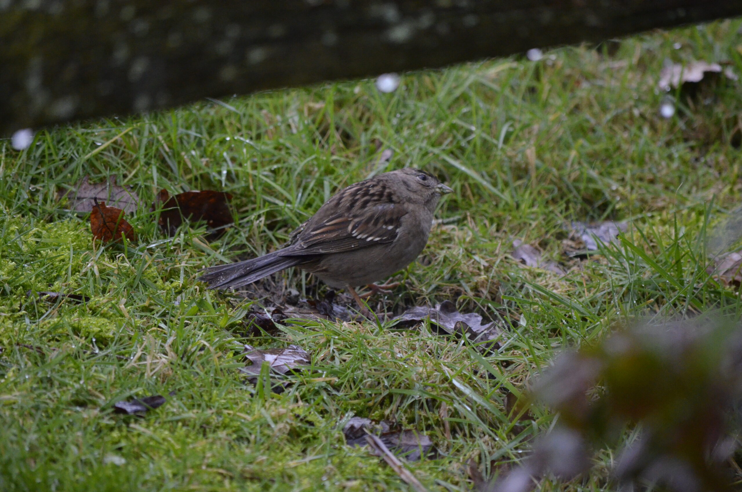
No particularly great photos today, not the least because I realized late in the session that my UV lens had a haze on it that was making photos low contrast with grey blacks. But I’ll share anyway – wigeons, mergansers, wood duck, the aforementioned cormorants, and a little pack of golden crowned sparrows.
The ride ended up being over 40 km. Hoping to better that tomorrow!