While the route was created in 2023, this is the first year I’ve organized some form of event around the Burnabop XL. I knew I wanted it to be around the peak of autumn foliage, and I knew I didn’t want it to be too big of a group. This latter point created quite a challenge with trying to organize a sort of ‘grand depart’ event. The main reason to avoid a large group is that the trails that make up this route are often hidden gems that are enjoyed by locals to take their dog or kid along, and I didn’t want a train of bikes to harsh the vibe.
So I set it up as an open window to depart at one’s leisure, whether with friends or solo. More on that later though, as this is about the pre-ride which I completed the day before the event.
It’s a good idea to pre-ride as close to the date as possible to provide the most accurate conditions for event day, but the literal day before doesn’t give a lot of time for any adjustments that may be needed. I didn’t expect anything major, so I didn’t worry about it too much. More on THAT soon as well.
I started the route just before 10am. Foliage was good. It was not raining to start, but rain was forecasted. Winds were a little blustery, adding some risk in the trees – but thankfully they petered off and became a non-issue.
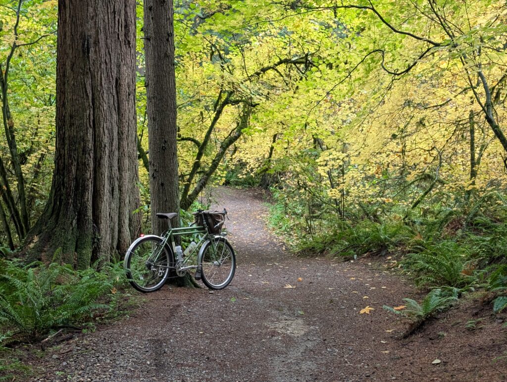
The vine maples were illuminating the otherwise grey day as noted above.
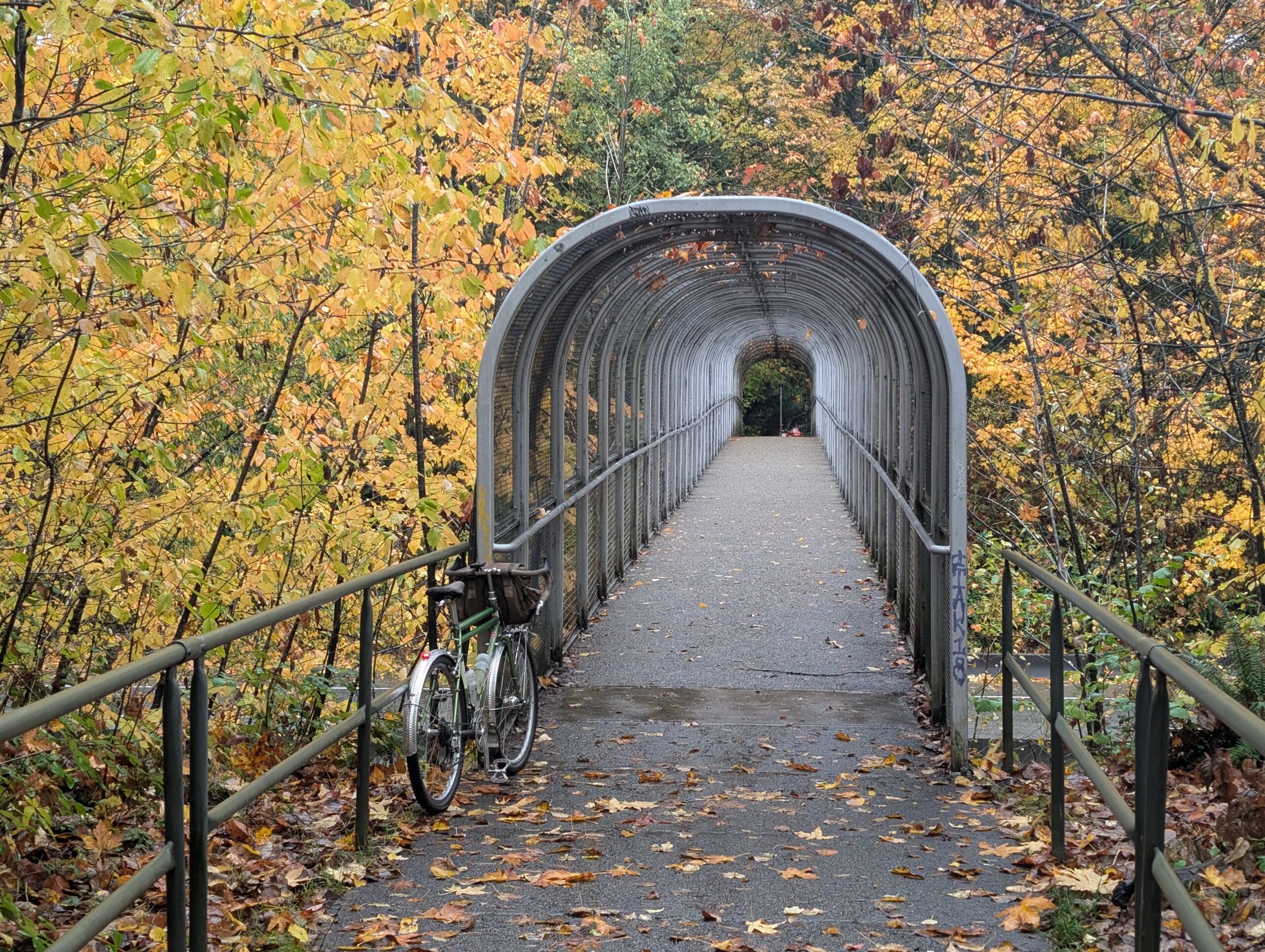
The north loop is challenging and almost entirely off road, while the south loop is longer but flatter.

While the south loop might be overall flatter and with more pavement, it’s also home to the highlights of the whole course.
So far other than a small detour due to construction that probably ran better than the original anyway, things were going great. The foliage was certainly delivering, the trails were running smooth.
Another small detour, no big deal. A hearse was parked in the bike lane, but they were actively carrying a coffin from the funeral service to it, so I let that one slide. Then when I reached Fraser Foreshore Park, a beautiful and expansive sanctuary, I found out it was closed right up the middle with no way through. Bummer.
So a last-minute re-route onto the adjacent road was necessary. Soon enough it reconnected with the trail network, along a creek and then up into Byrne ravine.
I climbed up and over the Edmonds area and down to Deer Lake, connecting over to Beecher Creek as the sun was setting. Beecher is a fun and unexpected little ravine trail that many end up skipping since it’s late in the route.
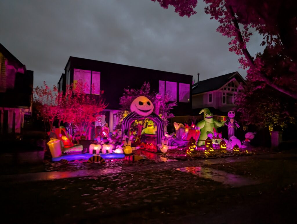
Being dark by the time I was passing through the North Burnaby neighbourhood towards the start/finish gate, I was able to enjoy some pretty epic Halloween displays:

All said and done: 77 km and ~1300m according to my GPS unit.
Leave a Reply